Back جبل دوڤريفچيل ARZ Dovrefjell Breton Dovrefjell Catalan Dovrefjell (kabukiran) CEB Dovrefjell Czech Dovrefjell Danish Dovrefjell Spanish Dovrefjell Estonian دووره فیل Persian Dovrefjell French
| Dovrefjell | |
|---|---|
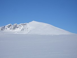
 Snøhetta, the highest mountain on Dovrefjell, in the winter. | |
| Highest point | |
| Peak | Snøhetta, Dovre, Innlandet |
| Elevation | 2,286 m (7,500 ft)[1] |
| Prominence | 1,672 m (5,486 ft) |
| Isolation | 82.2 km (51.1 mi) |
| Coordinates | 62°19′11″N 9°16′05″E / 62.319829°N 9.26803°E |
| Dimensions | |
| Area | 4,500 km2 (1,700 sq mi) |
| Geography | |
| Location | Central Norway |
| Range coordinates | 62°21′N 9°9′E / 62.350°N 9.150°E |
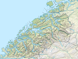
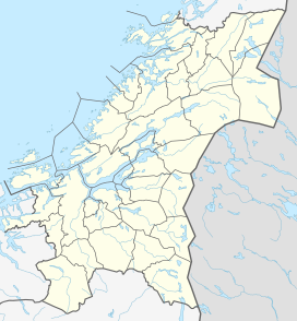
Dovrefjell is a mountain range in Central Norway that forms a natural barrier between Eastern Norway and Trøndelag. The mountain range is located in Innlandet, Møre og Romsdal, and Trøndelag counties in Norway. As a result of its central location, its valleys and passes have been heavily trafficked during and probably preceding historical times. Several mountain inns were established in the Middle Ages to house pilgrims traveling through Dovrefjell to Trondheim, and there are even ruins of an old leper colony in the northern area of it.

The main south-north highway (European route E6) and the Dovrebanen railway line both run through a mountain pass in the Dovrefjell range. The highway is a year-round highway but on rare occasions it is closed for short periods during heavy winter weather conditions. The mountain range runs through the municipalities of Oppdal in Trøndelag county, Folldal, Dovre, and Lesja in Innlandet county, and Sunndal in Møre og Romsdal county. The municipalities of Oppdal, Folldal, and Dovre, together, make up what is sometimes known as the Dovre Region.


As it is a natural habitat for many rare plants and animals, much of the Dovrefjell range has become a national park in several stages starting in 1911, when some plants were put under protection. When the railroad was built from Oslo to Trondheim in 1921, one of the marshes was preserved. In 1974, parts of the mountain range became Dovrefjell National Park and the park was extensively enlarged in 2002. Together with the neighboring Rondane National Park, the area has Norway (and Europe's) last stock of wild reindeer of Beringian origin. Dovrefjell (west of E6 / the Dovre Line) also has a stock of musk oxen, imported from East Greenland in 1932.
The Dovrefjell area has now been almost entirely protected as two national parks:
- Dovrefjell-Sunndalsfjella National Park, founded 2002, which encompasses the previous and much smaller Dovrefjell National Park.
- Dovre National Park, founded 2003, connecting the protected areas in the Dovrefjell-Sunndalsfjella National Park with Rondane National Park.
The highest mountain in the region is the 2,286-metre (7,500 ft) tall Snøhetta. The range provides cross-country skiing and hiking opportunities. The river Driva, running north through the municipality of Oppdal, has its source in the Dovrefjell range.
- ^ "Snøhetta". PeakVisor. Retrieved 12 February 2022.


