Back تسوكوبا Arabic تسوكوبا ARZ تسوکوبا، ایباراکی AZB Цукуба Byelorussian Цукуба Bulgarian Tsukuba Catalan Цукуба CE Tsukuba-shi CEB Cukuba (Ibaraki) Czech Tsukuba (Ibaraki) German
Tsukuba
つくば市 | |
|---|---|
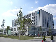
 View of Mount Tsukuba and Tsukuba Center | |
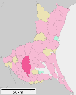
 Location of Tsukuba in Ibaraki Prefecture | |
| Coordinates: 36°5′0.5″N 140°4′35.2″E / 36.083472°N 140.076444°E | |
| Country | Japan |
| Region | Kantō |
| Prefecture | Ibaraki |
| First official recorded | 180 AD |
| Tsukuba town settled | April 1, 1889 |
| Tsukuba city settled | November 30, 1987 |
| Government | |
| • Mayor | Tatsuo Igarashi (from November 2016) |
| Area | |
| 283.72 km2 (109.54 sq mi) | |
| Population (January 1, 2024) | |
| 256,526 | |
| • Density | 900/km2 (2,300/sq mi) |
| • Metro [1] (2015) | 843,402 (19th) |
| Time zone | UTC+9 (Japan Standard Time) |
| Address | 2530-2 Karima, Tsukuba-shi, Ibaraki-ken 305-8555 |
| Climate | Cfa |
| Website | Official website |
| Symbols | |
| Bird | Ural owl |
| Flower | Hoshizaki-yukinoshita (Saxifraga stolonifera Curtis f. aptera (Makino) H.Hara) |
| Tree | Japanese zelkova |


Tsukuba (つくば市, Tsukuba-shi) is a city located in Ibaraki Prefecture, Japan. As of January 1, 2024, the city had an estimated population of 256,526 in 121,001 households and a population density of 900 persons per km2. The percentage of the population aged over 65 was 20.3%.[2] The total area of the city is 283.72 square kilometres (109.54 sq mi). It is known as the location of the Tsukuba Science City (筑波研究学園都市, Tsukuba Kenkyū Gakuen Toshi), a planned science park developed in the 1960s.
- ^ "UEA Code Tables". Center for Spatial Information Science, University of Tokyo. Archived from the original on January 9, 2019. Retrieved January 26, 2019.
- ^ "Ibaraki prefectural official statistics" (in Japanese). Japan.[permanent dead link]


