Back Vaals Afrikaans فالس (هولندا) Arabic Vaals Catalan Gemeente Vaals CEB Vaals Czech Vaals Danish Vaals German Vaals Esperanto Vaals Spanish Vaals Basque
Vaals
Vols | |
|---|---|
 View of Vaals | |
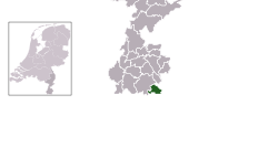
 Location in Limburg | |
| Coordinates: 50°46′N 6°1′E / 50.767°N 6.017°E | |
| Country | Netherlands |
| Province | Limburg |
| Government | |
| • Body | Municipal council |
| • Mayor | Harry Leunessen (PvdA) |
| Area | |
| • Total | 23.90 km2 (9.23 sq mi) |
| • Land | 23.89 km2 (9.22 sq mi) |
| • Water | 0.01 km2 (0.004 sq mi) |
| Elevation | 200 m (700 ft) |
| Highest elevation | 322.7 m (1,058.7 ft) |
| Population (January 2021)[5] | |
| • Total | 10,084 |
| • Density | 422/km2 (1,090/sq mi) |
| Demonym | Vaalzer |
| Time zone | UTC+1 (CET) |
| • Summer (DST) | UTC+2 (CEST) |
| Postcode | 6290–6295 |
| Area code | 043 |
| Website | www |

Vaals (Dutch: [vaːls] ; Vaals dialect: Vols [vɔls])[tone?] is a town in the extreme southeastern part of the Dutch province of Limburg, itself in the southeast of the Netherlands.
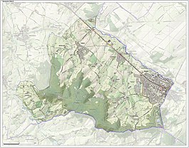
The municipality covers an area of 23.90 km2 (9.23 sq mi).It is situated in the western foothills of the Ardennes–Eifelrange and lies some 23 km (14 mi) east of Maastricht and 5 km (3.1 mi) west of the German city of Aachen.
Vaals directly adjoins both Belgium and Germany. As such three national borders meet at a point known as the Drielandenpunt and very near the highest point in the Netherlands, the Vaalserberg. The Vaalserberg was previously known as "Hubertusberg", so named for the eighth century St.Hubertus.
- ^ "Burgemeester & Wethouders" [Mayor & Aldermen] (in Dutch). Gemeente Vaals. Retrieved 26 May 2024.
- ^ "Kerncijfers wijken en buurten 2020" [Key figures for neighbourhoods 2020]. StatLine (in Dutch). CBS. 24 July 2020. Retrieved 19 September 2020.
- ^ "Postcodetool for 6291AT". Actueel Hoogtebestand Nederland (in Dutch). Het Waterschapshuis. Retrieved 1 December 2013.
- ^ "Wat is het Normaal Amsterdams Peil (NAP)?" [What is the Amsterdam Ordnance Datum]. rijksoverheid.nl (in Dutch). Government of the Netherlands. Archived from the original on 3 December 2013. Retrieved 1 December 2013.
- ^ "Bevolkingsontwikkeling; regio per maand" [Population growth; regions per month]. CBS Statline (in Dutch). CBS. 1 January 2021. Retrieved 2 January 2022.

