Paghimo ni bot Lsjbot. |
| Arroyo Guayase | |
| Suba nga anhianhi | |
| Nasod | |
|---|---|
| Departamento | El Beni |
| Gitas-on | 141 m (463 ft) |
| Tiganos | 13°15′S 64°09′W / 13.25°S 64.15°W |
| Timezone | BOT (UTC-4) |
| GeoNames | 3915347 |
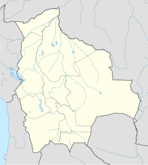
Suba nga anhianhi ang Arroyo Guayase sa Bolibiya.[1] Nahimutang ni sa departamento sa El Beni, sa amihanang bahin sa nasod, 700 km sa amihanan sa Sucre ang ulohan sa nasod. Ang Arroyo Guayase mao ang bahin sa tubig-saluran sa Amazon River.
Ang klima nga savanna.[2] Ang kasarangang giiniton 25 °C. Ang kinainitan nga bulan Septiyembre, sa 27 °C, ug ang kinabugnawan Hunyo, sa 24 °C.[3] Ang kasarangang pag-ulan 1,961 milimetro matag tuig. Ang kinabasaan nga bulan Pebrero, sa 377 milimetro nga ulan, ug ang kinaugahan Agosto, sa 18 milimetro.[4]
- ↑ Cite error: Invalid
<ref>tag; no text was provided for refs namedgn3915347 - ↑ Cite error: Invalid
<ref>tag; no text was provided for refs namedkoppen - ↑ Cite error: Invalid
<ref>tag; no text was provided for refs namednasa - ↑ Cite error: Invalid
<ref>tag; no text was provided for refs namednasarain

