Back Districto de Bamberg AN منطقة بامبيرغ Arabic Landkroas Bamberg BAR Бамберг (раён) Byelorussian Zemský okres Bamberk Czech Landkreis Bamberg Danish Landkreis Bamberg German Bamberg (district) English Distrikto Bamberg Esperanto Distrito de Bamberg Spanish
Paghimo ni bot Lsjbot. |
| Landkreis Bamberg | ||
| Distrito | ||
|
||
| Nasod | ||
|---|---|---|
| Estado pederal | Bavaria | |
| Distrito nga gobyerno | Upper Franconia | |
| Gitas-on | 275 m (902 ft) | |
| Tiganos | 49°51′51″N 10°50′48″E / 49.86419°N 10.84661°E | |
| Area | 1,168.00 km2 (451 sq mi) | |
| Population | 143,758 (2014-01-03) [1] | |
| Density | 123 / km2 (319 / sq mi) | |
| Timezone | CET (UTC+1) | |
| - summer (DST) | CEST (UTC+2) | |
| GeoNames | 3220844 | |
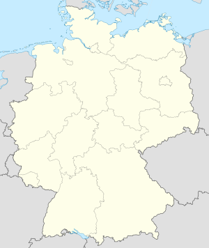
Distrito ang Landkreis Bamberg sa Alemanya.[1] Nahimutang ni sa distrito nga gobyerno sa Upper Franconia ug estado pederal sa Bavaria, sa sentro nga bahin sa nasod, 300 km sa habagatan-kasadpan sa Berlin ang ulohan sa nasod. Adunay 143,758 ka molupyo.[1] Naglangkob kin og 1,168 ka kilometro kwadrado. Landkreis Bamberg mopakigbahin sa usa ka utlanan sa Landkreis Lichtenfels, Bamberg, Landkreis Bayreuth, Landkreis Forchheim, Landkreis Erlangen-Höchstadt, Landkreis Neustadt an der Aisch-Bad Windsheim, Landkreis Kitzingen, Landkreis Schweinfurt, Landkreis Haßberge, ug Landkreis Coburg.
Ang yuta sa Landkreis Bamberg kabungtoran sa amihang-sidlakan, apan sa habagatang-kasadpan nga kini mao ang patag.[saysay 1]
Landkreis Bamberg may sa mosunod nga mga subdibisyon:
- Scheßlitz
- Hallstadt
- Baunach
- Schlüsselfeld
- Zapfendorf
- Rattelsdorf
- Hirschaid
- Heiligenstadt
- Ebrach
- Buttenheim
- Burgwindheim
- Burgebrach
- Lisberg
- Lauter
- Königsfeld
- Kemmern
- Gundelsheim
- Gerach
- Frensdorf
- Breitengüßbach
- Bischberg
- Altendorf
- Stegaurach
- Stadelhofen
- Schönbrunn im Steigerwald
- Reckendorf
- Priesendorf
- Pommersfelden
- Pettstadt
- Oberhaid
- Memmelsdorf
- Litzendorf
- Wattendorf
- Walsdorf
- Viereth-Trunstadt
- Strullendorf
- Ebracher Forst
- Eichwald (Bawaria)
- Geisberger Forst
- Hauptsmoorwald
- Koppenwinder Forst
- Lindach (obszar wolny administracyjnie)
- Semberg
- Steinachsrangen
- Winkelhofer Forst
- Zückshuter Forst
Hapit nalukop sa lasang nga sagolsagol ang palibot sa Landkreis Bamberg.[3] Dunay mga 230 ka tawo kada kilometro kwadrado sa palibot sa Landkreis Bamberg medyo hilabihan populasyon.[4] Ang klima hemiboreal.[5] Ang kasarangang giiniton 8 °C. Ang kinainitan nga bulan Hulyo, sa 20 °C, ug ang kinabugnawan Disyembre, sa −6 °C.[6] Ang kasarangang pag-ulan 937 milimetro matag tuig. Ang kinabasaan nga bulan Mayo, sa 112 milimetro nga ulan, ug ang kinaugahan Marso, sa 24 milimetro.[7]
| ||||||||||||||||||||||||||||||||||||||||||||||||||||||||||||||||||||||||||||||||||||||||||||||||||||||||||||||||||||||||||||
- ↑ 1.0 1.1 1.2 Cite error: Invalid
<ref>tag; no text was provided for refs namedgn3220844 - ↑ Cite error: Invalid
<ref>tag; no text was provided for refs namedvp - ↑ Cite error: Invalid
<ref>tag; no text was provided for refs namednasalandcover - ↑ Cite error: Invalid
<ref>tag; no text was provided for refs namednasapop - ↑ Cite error: Invalid
<ref>tag; no text was provided for refs namedkoppen - ↑ 6.0 6.1 Cite error: Invalid
<ref>tag; no text was provided for refs namednasa - ↑ Cite error: Invalid
<ref>tag; no text was provided for refs namednasarain
Cite error: <ref> tags exist for a group named "saysay", but no corresponding <references group="saysay"/> tag was found


