Back Caicos-Insln BAR Caicos Islands CEB Caicos Czech Îles Caïques French Caicos Polish Ilhas Caicos Portuguese 凱科斯群島 Chinese
| Caicos-Inseln | ||
|---|---|---|
 | ||
| Gewässer | Atlantischer Ozean | |
| Geographische Lage | 21° 39′ N, 71° 54′ W | |
|
| ||
| Anzahl der Inseln | ca. 30 | |
| Hauptinsel | Providenciales | |
| Gesamte Landfläche | 460,2 km² | |
| Einwohner | 26.519 | |
 | ||
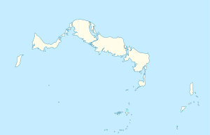
Die Caicos-Inseln (englisch Caicos Islands) sind eine Inselgruppe im Atlantischen Ozean etwa 200 Kilometer nördlich der Insel Hispaniola. Zusammen mit den knapp 40 Kilometer südöstlich liegenden Turks-Inseln bilden sie das Britische Überseegebiet der Turks- und Caicosinseln.
Zur Inselgruppe gehören über 30 Inseln, zu den bekannten gehören die Hauptinsel Providenciales sowie West Caicos, North Caicos, Middle Caicos, East Caicos und South Caicos.
