Back Yos Sudarso-eiland Afrikaans جزيرة يوس سودارسو Arabic جزيره يوس سودارسو ARZ Islla de Yos Sudarso AST Yos-Sudarso Azerbaijani Yos Sudarso Catalan Pulau Dolak (pulo sa Provinsi Papua, lat -7,89, long 138,38) CEB Yos Sudarso (ostrov) Czech Ynys Yos Sudarso Welsh Νήσος Γιος Σουντάρσο Greek
| Yos-Sudarso-Insel | ||
|---|---|---|
 | ||
| Gewässer | Arafurasee | |
| Geographische Lage | 7° 55′ S, 138° 30′ O | |
|
| ||
| Länge | 180 km | |
| Breite | 100 km | |
| Fläche | 11.460 km² | |
| Höchste Erhebung | 10 m | |
| Einwohner | 11.000 <1 Einw./km² | |
| Hauptort | Kimaam | |
 | ||
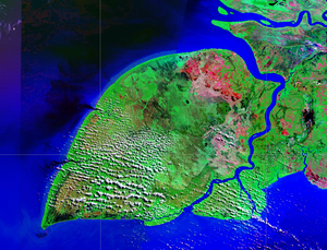
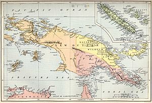
Die Yos-Sudarso-Insel (Pulau Yos Sudarso) oder Kimaan ist eine ca. 180 km lange und 100 km breite indonesische Insel vor der Südwestküste Neuguineas.
