Back Pazifische Taifunsaison 2014 German Temporada de tifones en el Pacífico de 2014 Spanish Saison cyclonique 2014 dans l'océan Pacifique nord-ouest French 2014年の台風 Japanese 2014년 태풍 Korean Tyfoonseizoen van de Grote Oceaan 2014 Dutch Temporada de tufões no Pacífico de 2014 Portuguese 2014 Pacific typhoon season SIMPLE ฤดูพายุไต้ฝุ่นแปซิฟิก พ.ศ. 2557 Thai Panahon ng bagyo sa Pasipiko ng 2014 Tagalog
| 2014 Pacific typhoon season | |
|---|---|
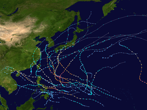
 Season summary map | |
| Seasonal boundaries | |
| First system formed | January 10, 2014 |
| Last system dissipated | January 1, 2015 |
| Strongest storm | |
| Name | Vongfong |
| • Maximum winds | 215 km/h (130 mph) (10-minute sustained) |
| • Lowest pressure | 900 hPa (mbar) |
| Seasonal statistics | |
| Total depressions | 32 |
| Total storms | 23 |
| Typhoons | 11 |
| Super typhoons | 8 (unofficial) |
| Total fatalities | 572 total |
| Total damage | $12.92 billion (2014 USD) |
| Related articles | |
The 2014 Pacific typhoon season was a slightly below average season in terms of named storms, but featured the highest amount of Category 5 typhoons since 1997. This was mainly due to a developing El Niño that favors multiple powerful storms to form in the basin. The season formed twenty-three tropical storms (including one that crossed over from the Eastern/Central Pacific), eleven typhoons, eight super typhoons, and seven Category 5 typhoons. The season's peak months August and September saw minimal activity caused by an unusually strong and a persistent suppressing phase of the Madden–Julian oscillation (MJO). The season ran throughout 2014, though most tropical cyclones typically develop between May and October. The season began with the development of Tropical Storm Lingling on January 18, and ended after Tropical Storm Jangmi which dissipated on January 1 of the next year.
The season was not as active, deadly and costly as the previous typhoon season, but was notable for producing a series of powerful super typhoons. In fact, this season saw the most storms reaching Category 5 intensity on the Saffir–Simpson scale (seven–Neoguri, Rammasun, Halong, Genevieve, Vongfong, Nuri and Hagupit) since 1997. Two of those were notable; Rammasun became one of only four Category 5 typhoons recorded in the South China Sea with the others being Typhoon Pamela in 1954, Typhoon Rai in 2021 and Typhoon Yagi in 2024. The typhoon killed about 200 people and caused roughly US$8 billion worth of damage in China and the Philippines. Genevieve, a long-lasting system, was the first since 1999 for a system to exist in all three Northern Pacific basins.[1]
The scope of this article is limited to the Pacific Ocean to the north of the equator between 100°E and 180th meridian. Within the northwestern Pacific Ocean, there are two separate agencies that assign names to tropical cyclones which can often result in a cyclone having two names. The Japan Meteorological Agency (JMA) will name a tropical cyclone should it be judged to have 10-minute sustained wind speeds of at least 65 kilometres per hour (40 mph) anywhere in the basin, whilst the Philippine Atmospheric, Geophysical and Astronomical Services Administration (PAGASA) assigns names to tropical cyclones which move into or form as a tropical depression in their area of responsibility located between 135°E–115°E and between 5°N–25°N regardless of whether or not a tropical cyclone has already been given a name by the JMA. Tropical depressions that are monitored by the United States' Joint Typhoon Warning Center (JTWC) are given a number with a "W" suffix.
- ^ Saunders, Mark; Lea, Adam (January 27, 2015). Summary of 2014 NW Pacific Typhoon Season and Verification of Author's Seasonal Forecasts (PDF) (Report). Tropical Storm Risk Consortium. Archived (PDF) from the original on March 15, 2015. Retrieved April 7, 2015.