Back Laôt Andaman ACE Andamanse See Afrikaans अंडमान सागर ANP بحر أندامان Arabic আন্দামান সাগৰ Assamese Mar d'Andamán AST Andaman dənizi Azerbaijani آندامان دنیزی AZB Андаман диңгеҙе Bashkir Segara Andaman BAN
| Andaman Sea | |
|---|---|
| Burma Sea | |
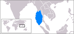
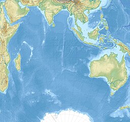
 Location of Andaman Sea in the Indian Ocean | |
| Coordinates | 10°N 96°E / 10°N 96°E |
| Type | Sea |
| Basin countries |
|
| Max. length | 1,202 km (747 mi) |
| Max. width | 647 km (402 mi) |
| Surface area | 797,000 km2 (307,700 sq mi) |
| Average depth | 1,096 m (3,596 ft) |
| Max. depth | 4,198 m (13,773 ft) |
| Water volume | 660,000 km3 (158,000 cu mi) |
| References | [1][2][3] |
| Andaman Sea | |
|---|---|
| Burmese name | |
| Burmese | ကပ္ပလီပင်လယ် |
| IPA | Kappali Pinlae |
| Thai name | |
| Thai | ทะเลอันดามัน |
| RTGS | Thale Andaman |
| Malay name | |
| Malay | Laut Andaman |
| Indonesian name | |
| Indonesian | Laut Andaman |
| Bengali name | |
| Bengali | আন্দামান সাগর |
| Hindi name | |
| Hindi | अंडमान सागर |
The Andaman Sea (historically also known as the Burma Sea)[4] is a marginal sea of the northeastern Indian Ocean bounded by the coastlines of Myanmar and Thailand along the Gulf of Martaban and the west side of the Malay Peninsula, and separated from the Bay of Bengal to its west by the Andaman Islands and the Nicobar Islands. Its southern end is at Breueh Island just north of Sumatra, with the Strait of Malacca further southeast.
Traditionally, the sea has been used for fishery and transportation of goods between the coastal countries and its coral reefs and islands are popular tourist destinations. The fishery and tourist infrastructure was severely damaged by the December 2004 Indian Ocean earthquake and tsunami.
- ^ Andaman Sea, Great Soviet Encyclopedia (in Russian)
- ^ Andaman Sea, Encyclopædia Britannica on-line
- ^ Cite error: The named reference
indjst.orgwas invoked but never defined (see the help page). - ^ Cite error: The named reference
IHOwas invoked but never defined (see the help page).
