Back أنغيليتا Arabic Anguillita Island CEB Anguillita German Anguillita Spanish Anguillita Estonian Anguillita Basque Anguillita French Anguillita Galician Anguillita Croatian Anguillita Italian
 | |
| Geography | |
|---|---|
| Location | Atlantic Ocean |
| Coordinates | 18°09′29.3″N 63°10′32.6″W / 18.158139°N 63.175722°W |
| Archipelago | Antilles |
| Administration | |
United Kingdom | |
| British Overseas Territory | Anguilla |
| Additional information | |
| Time zone | |
| ISO code | AI |
| Anguillita Lighthouse | |
| Foundation | concrete base |
| Construction | aluminium skeletal tower[1][2] |
| Height | 8 m (26 ft) |
| Shape | square prism skeletal tower with beacon |
| Power source | solar power |
| Focal height | 15 m (49 ft) |
| Range | 5 nmi (9.3 km; 5.8 mi) |
| Characteristic | Fl(2) W 16s |
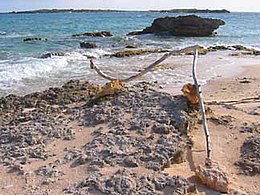
Anguillita is a small, uninhabited rocky island off the western tip of, and part of the territory of Anguilla,[3] located in the Caribbean. It's the dependency's southernmost point, located at coordinates 18°9' N, 63°11' W. Its average elevation is inverted compared to most, at -89 feet[clarification needed] below sea level.[3]
- ^ Rowlett, Russ. "Lighthouses of Anguilla". The Lighthouse Directory. University of North Carolina at Chapel Hill. Retrieved 27 August 2016.
- ^ List of Lights, Pub. 110: Greenland, The East Coasts of North and South America (Excluding Continental U.S.A. Except the East Coast of Florida) and the West Indies (PDF). List of Lights. United States National Geospatial-Intelligence Agency. 2016.
- ^ a b "Anguillita Island." Archived 2012-04-23 at the Wayback Machine Chinci World Atlas Archived 2013-10-12 at the Wayback Machine. Accessed October 2011.

