Back اشتید AZB Ashtead CEB Ashtead Spanish Ashtead Basque اشتید Persian Ashtead French Ashtead Dutch Ashtead Polish Ashtead Swedish
| Ashtead | |
|---|---|
| Village | |
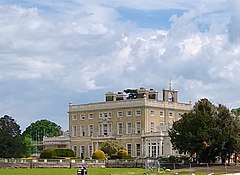
 Ashtead Park House, a school since the 1920s | |
 Barnett Wood Lane with pond to the right | |
Location within Surrey | |
| Area | 11.59 km2 (4.47 sq mi) |
| Population | 14,169 (2011 census)[1] |
| • Density | 1,223/km2 (3,170/sq mi) |
| OS grid reference | TQ1858 |
| Civil parish |
|
| District | |
| Shire county | |
| Region | |
| Country | England |
| Sovereign state | United Kingdom |
| Post town | Ashtead |
| Postcode district | KT21 |
| Dialling code | 01372 |
| Police | Surrey |
| Fire | Surrey |
| Ambulance | South East Coast |
| UK Parliament | |
Ashtead /ˈæʃtɛd/ is a village in the Mole Valley district of Surrey, England, approximately 16 mi (26 km) south of central London. Ashtead is on the single-carriageway A24 between Epsom and Leatherhead. The village is on the northern slopes of the North Downs and is in the catchment area of The Rye, a tributary of the River Mole.
The earliest archaeological evidence for human activity in the village is from the Stone Age. At several points in its history, including during the early Roman period, Ashtead has been a centre for brick and tile manufacture. From medieval times until the late 19th century, Ashtead was primarily an agricultural settlement. Residential development was catalysed by the opening of the railway line between Epsom and Leatherhead in 1859 and by the breakup of the Ashtead Park estate in the 1880s. Housebuilding continued into the 20th century, reaching a peak in the 1930s. Future expansion is now constrained by the Metropolitan Green Belt, which encircles the village.
There are two nature reserves in the village: Ashtead Common, to the north west of the centre, forms part of a Site of Special Scientific Interest and is owned by the Corporation of London; Ashtead Park, to the east of the centre is a Local Nature Reserve owned by the District Council.
- ^ Key Statistics; Quick Statistics: Population Density Archived 11 February 2003 at the Wayback Machine United Kingdom Census 2011 Office for National Statistics Retrieved 20 December 2013
