Back بارفلور Arabic بارفلور ARZ Barfleur BUG Barfleur Catalan БагӀфлегӀ CE Barfleur CEB Barfleur Czech Barfleur German Barfleur DIQ Μπαρφλέρ Greek
Barfleur | |
|---|---|
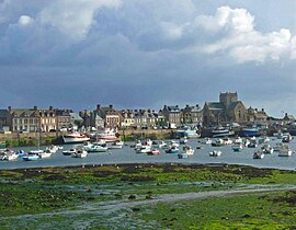
 Barfleur harbour | |
| Coordinates: 49°40′16″N 1°15′48″W / 49.6711°N 1.2633°W | |
| Country | France |
| Region | Normandy |
| Department | Manche |
| Arrondissement | Cherbourg |
| Canton | Val-de-Saire |
| Intercommunality | CA Cotentin |
| Area 1 | 0.6 km2 (0.2 sq mi) |
| Population (2021)[1] | 546 |
| • Density | 910/km2 (2,400/sq mi) |
| Time zone | UTC+01:00 (CET) |
| • Summer (DST) | UTC+02:00 (CEST) |
| INSEE/Postal code | 50030 /50760 |
| Elevation | 4 m (13 ft) |
| 1 French Land Register data, which excludes lakes, ponds, glaciers > 1 km2 (0.386 sq mi or 247 acres) and river estuaries. | |
Barfleur (French pronunciation: [baʁflœʁ]) is a commune and fishing village in Manche, Normandy, northwestern France. It is a member of Les Plus Beaux Villages de France (The Most Beautiful Villages of France) Association.
- ^ "Populations légales 2021" (in French). The National Institute of Statistics and Economic Studies. 28 December 2023.


