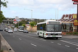
| Belmont Geelong, Victoria | |||||||||||||||
|---|---|---|---|---|---|---|---|---|---|---|---|---|---|---|---|
 High Street, Belmont | |||||||||||||||
 | |||||||||||||||
| Coordinates | 38°10′23″S 144°20′28″E / 38.173°S 144.341°E | ||||||||||||||
| Population | 14,054 (2016 census)[1] | ||||||||||||||
| • Density | 1,528/km2 (3,956/sq mi) | ||||||||||||||
| Postcode(s) | 3216 | ||||||||||||||
| Area | 9.2 km2 (3.6 sq mi) | ||||||||||||||
| Location | 4 km (2 mi) from Geelong | ||||||||||||||
| LGA(s) | City of Greater Geelong | ||||||||||||||
| State electorate(s) | |||||||||||||||
| Federal division(s) | Corio | ||||||||||||||
| |||||||||||||||
Belmont is a southern suburb of Geelong, Victoria, Australia. The name means "beautiful hill".[2] Belmont is geographically separated from the Geelong central business district by the Barwon River. The suburb is primarily residential, with some light industry along Barwon Heads Road. The suburb is part of the City of Greater Geelong local government area. At the 2011 census, Belmont had a population of 13,616. [1]
- ^ a b Australian Bureau of Statistics (27 June 2017). "Belmont (State Suburb) - Vic". 2016 Census QuickStats. Retrieved 16 November 2017.
- ^ Australian Places – Belmont

