Back بيرخم Arabic Berchem (Antwerpen) BAR Berchem Catalan Berchem (lungsod sa Belhika) CEB Berchem (Antwerpen) German Berchem Esperanto برشم Persian Berchem (Anvers) French Berchem (Anversa) Italian Berchem (Antwerpen) Dutch
Berchem | |
|---|---|
 | |
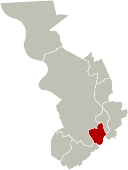
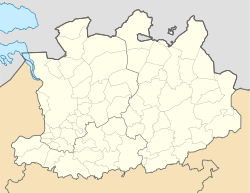
 Location of Berchem in Antwerp | |
| Coordinates: 51°12′00″N 4°25′00″E / 51.20000°N 4.41667°E | |
| Country | |
| Community | |
| Region | |
| Province | |
| Arrondissement | Antwerp |
| Municipality | Antwerp |
| Area | |
| • Total | 5.70 km2 (2.20 sq mi) |
| Population (2021)[1] | |
| • Total | 43,180 |
| • Density | 7,600/km2 (20,000/sq mi) |
| Postal codes | 2600 |
| Area codes | 03 |
| Website | [1] |
Berchem (Dutch pronunciation: [ˈbɛrxɛm] ) is a southern district of the municipality and city of Antwerp in the Flemish Region of Belgium. Berchem is located along the old Grote Steenweg (Dutch for 'Big Paved Road') that has connected Brussels to Antwerp for several centuries; the town borders the districts of Deurne, Borgerhout, Wilrijk and Antwerp and the municipality of Mortsel. Berchem itself consists of three quarters, Oud Berchem, Groenenhoek and Nieuw Kwartier.
The 'Ring', Antwerp's circular motorway which follows the track of the former city defense walls, cuts Berchem in two parts, separating the urban inner city area of Oud-Berchem (intra muros) from the more residential and suburban areas Groenenhoek, Pulhof and Nieuw Kwartier (extra muros).
- ^ a b "Bevolking per statistische sector - Sector 11002T". Statistics Belgium. Retrieved 11 May 2022.


