Back تلال بيركلى ARZ Berkeley Hills CEB برکلی هیلز Persian Collines de Berkeley French Berkeley Hills LLD Berkeley Hills Dutch Berkeley Hills NN Đồi Berkeley Vietnamese
| Berkeley Hills | |
|---|---|
 | |
| Highest point | |
| Elevation | 581 m (1,906 ft) |
| Geography | |
Location of Berkeley Hills in California[1] | |
| Country | United States |
| State | California |
| District | Alameda County |
| Range coordinates | 37°52′58″N 122°14′16″W / 37.88278°N 122.23778°W |
| Topo map | USGS  |
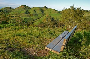
The Berkeley Hills are a range of the Pacific Coast Ranges, and overlook the northeast side of the valley that encompasses San Francisco Bay. They were previously called the "Contra Costa Range/Hills"[2][3] (from the original Spanish Sierra de la Contra Costa), but with the establishment of Berkeley and the University of California, the current usage was applied by geographers and gazetteers.
- ^ "Berkeley Hills". Geographic Names Information System. United States Geological Survey, United States Department of the Interior. Retrieved 2009-05-04.
- ^ Engineers, United States Army Corps of (July 28, 1856). "Reports of Explorations and Surveys for a Railroad from the Mississippi River to the Pacific Ocean...1853-54". Archived from the original on July 28, 2022. Retrieved September 7, 2022 – via Google Books.
- ^ "The Atlantic, July 1874". The Atlantic. July 1874. Archived from the original on 2022-08-01. Retrieved 2022-08-01.

