Back Blitar Afrikaans بليتار Arabic Kota Blitar BAN Blitar Kota BEW Blitar (lungsod sa Indonesya) CEB Blitar German Blitar Esperanto بلیتر Persian Blitar Finnish Blitar French
Blitar | |
|---|---|
| City of Blitar Kota Blitar | |
Clockwise from top left: Sukarno Mausoleum, Penataran Temple, Plumbangan Temple, Istana Gebang | |
| Motto: Kridha Hangudi Jaya | |
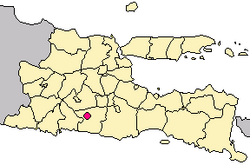
 Location within East Java | |
| Coordinates: 8°06′S 112°09′E / 8.100°S 112.150°E | |
| Country | |
| Region | Java |
| Province | |
| City | April 1, 1906 |
| Government | |
| • Mayor | Santoso |
| • Vice Mayor | Tjutjuk Sunario |
| Area | |
| • Total | 32.57 km2 (12.58 sq mi) |
| Elevation | 167 m (548 ft) |
| Population (mid 2023 estimate) | |
| • Total | 159,781 |
| • Density | 4,900/km2 (13,000/sq mi) |
| [1] | |
| Time zone | UTC+7 (Indonesia Western Time) |
| Postcode | 66100 |
| Area code | (+62) 342 |
| Vehicle registration | AG |
| Website | blitarkota |
Blitar is a landlocked city in East Java, Indonesia, about 73 km from Malang and 167 km from Surabaya. The area lies within longitude 111° 40' – 112° 09' East and its latitude is 8° 06' South. The city of Blitar lies at an altitude on average 167 metres above sea level,[2] and is an enclave within Blitar Regency which surrounds the city on all sides. It covers an area of 32.57 km2, and had a population of 131,968 at the 2010 Census[3] and 149,149 at the 2020 Census;[4] the official estimate as at mid 2023 was 159,781 (comprising 79,651 males and 80,130 females).[1]
The city is noted as the location of the grave of Sukarno, the first president of Indonesia, five kilometers from the city plaza. The Istana Gebang (Gebang palace) where Sukarno lived as a child is nearby and has been converted into a museum. containing numerous items commemorating Sukarno's place in Indonesian history.[5] In addition, the very active Kelud volcano is located just over 20 kilometers north of Blitar.
Blitar city is surrounded by four of the districts (kecamatan) of Blitar Regency - Kademangan, Garum, Nglegok and Sanankulon; added to the population of the city, this combined area of seven kecamatan had a total population in mid 2023 of 442,247 within 318.3 km2.[1]
- ^ a b c Badan Pusat Statistik, Jakarta, 28 February 2024, Kota Blitar Dalam Angka 2024 (Katalog-BPS 1102001.3572)
- ^ "BPS Provinsi Jawa Timur". jatim.bps.go.id. Retrieved 2018-09-09.
- ^ Biro Pusat Statistik, Jakarta, 2011.
- ^ Badan Pusat Statistik, Jakarta, 2021.
- ^ "Many memories: Photographs inside Istana Gebang tell their own stories about the life of young Sukarno and his family. (Photo by Mary Sasmiro) | Jakarta Post Travel". Archived from the original on 2014-06-06. Retrieved 2014-06-06.


