Back منطقه کلانشهری بولینق قرین، کنتاکی AZB Área metropolitana de Bowling Green Spanish منطقه کلانشهری بولینگ گرین، کنتاکی Persian باولنگ گرین، کینٹکی میٹروپولیٹن علاقہ Urdu
Bowling Green Metro | |
|---|---|
| Bowling Green Metropolitan Statistical Area | |
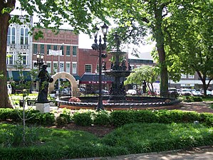
 Fountain Square Park, 2008 | |
 | |
| Country | |
| State | |
| Largest city | Bowling Green |
| Other cities | - Brownsville - Scottsville - Morgantown - Smiths Grove - Woodburn |
| Area | |
| • Total | 548 sq mi (1,420 km2) |
| Highest elevation | Pilot Knob[1]935 ft (285 m) |
| Lowest elevation | Confluence of the Green and Barren Rivers[2] 395 ft (120 m) |
| Population | |
| • Total | 165,732 (2,014)[3] |
| • Rank | 246th in the U.S. |
| • Density | 220.06/sq mi (54.4/km2) |

The Bowling Green Metropolitan Statistical Area, as defined by the United States Census Bureau, is an area consisting of four counties in Kentucky, anchored by the city of Bowling Green. As of 2014, the MSA had an estimated population of 165,732.
- ^ "Pilot Knob". Geographic Names Information System. United States Geological Survey, United States Department of the Interior. Retrieved on 2010-12-23
- ^ Groundwater Resources of Warren County, Kentucky Retrieved on 2010-12-23
- ^ "Archived copy". Archived from the original on 2015-05-04. Retrieved 2015-05-20.
{{cite web}}: CS1 maint: archived copy as title (link)