Back ব্ৰাহ্মণবাড়িয়া জিলা Assamese ব্রাহ্মণবাড়িয়া জেলা Bengali/Bangla ব্রাহ্মণবাড়িয়া জিলা BPY Brahmanbaria (Distrikt) German Brahmanbaria (zila) Spanish ناحیه برهمنبریه Persian Brahmanbaria (district) French ब्राह्मनबरिआ जिला Hindi Distretto di Brahmanbaria Italian 브라만바리아구 Korean
Brahmanbaria
ব্রাহ্মণবাড়িয়া | |
|---|---|
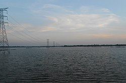
Clockwise from top-left: Shahid Minar in Brahmanbaria, Haripur Barabari, Kal Bhairab Temple, Akhaura, Arifil Mosque | |
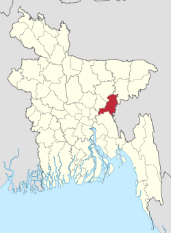
 Expandable map of Brahmanbaria District | |
 | |
| Coordinates: 23°59′N 91°07′E / 23.983°N 91.117°E | |
| Country | |
| Division | Chittagong |
| Established | 15 February 1984 (split from Comilla) |
| Headquarters | Brahmanbaria |
| Government | |
| • Deputy Commissioner | Hayat-ud-Dowllah Khan |
| Area | |
• Total | 1,881.20 km2 (726.34 sq mi) |
| Population | |
• Total | 3,306,563 |
| • Density | 1,800/km2 (4,600/sq mi) |
| Demonym | Brahmanbarian |
| Time zone | UTC+06:00 (BST) |
| Postal code | 3400 |
| Area code | 0851 |
| ISO 3166 code | BD-04 |
| HDI (2018) | 0.614[2] medium · 7th of 21 |
| Website | www |
Brahmanbaria (Bengali: ব্রাহ্মণবাড়িয়া, romanized: Brammôṇbaṛiya) is a district in eastern Bangladesh located in the Chittagong Division. Geographically, it is mostly farmland and is topographically part of the Gangetic Plain. It is bounded by the districts of Kishoreganj and Habiganj to the north, Narsingdi District and Narayanganj to the west, Comilla to the south, and the Indian state of Tripura to the east. It was a part of Comilla District until 15 February 1984.[3]
- ^ Cite error: The named reference
2022censuswas invoked but never defined (see the help page). - ^ "Sub-national HDI - Area Database - Global Data Lab". hdi.globaldatalab.org. Retrieved 2020-03-18.
- ^ Musa, Muhammad. Brahmanbariar Itibrittyo, Shetu Prokashoni, Brahmanbaria,1998.


