Back ব্রহ্মপুরী Bengali/Bangla ব্রহ্মপুরী BPY Brahmapuri (Maharashtra) Spanish બ્રહ્મપુરી Gujarati ब्रह्मपुरी Hindi Brahmapuri Italian ब्रह्मपुरी Marathi Brahmapuri Malay Brahmapuri Dutch Brahmapuri Portuguese
This article needs additional citations for verification. (July 2022) |
Bramhapuri | |
|---|---|
Village | |
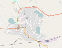
 Overview of Bramhapuri Town | |
Location in Bramhapuri taluka | |
| Coordinates: 20°36′24″N 79°51′52″E / 20.6068°N 79.8644°E | |
| Country | |
| State | Maharashtra |
| Region | Vidarbha |
| District | Chandrapur |
| Taluka | Bramhapuri |
| Area | |
| • Total | 15 km2 (6 sq mi) |
| Elevation | 229.5 m (753.0 ft) |
| Population (2011) | |
| • Total | 36,025 |
| • Density | 2,400/km2 (6,200/sq mi) |
| Languages | |
| • Official | Marathi |
| Time zone | UTC+5:30 (IST) |
| PIN | 441206 |
| Telephone code | 07177 |
| Vehicle registration | MH34 |
| Nearest city | Nagpur |

Bramhapuri is a town and eponymous headquarters of Bramhapuri taluka in Chandrapur district in the state of Maharashtra, India.
