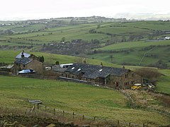
| Briercliffe | |
|---|---|
 Monk Hall farm | |
Location within Lancashire | |
| Area | 6.53 sq mi (16.9 km2) [1] |
| Population | 4,031 (2011) [1] |
| • Density | 617/sq mi (238/km2) |
| OS grid reference | SD8749034897 |
| Civil parish |
|
| District | |
| Shire county | |
| Region | |
| Country | England |
| Sovereign state | United Kingdom |
| Post town | BURNLEY |
| Postcode district | BB10 |
| Dialling code | 01282 |
| Police | Lancashire |
| Fire | Lancashire |
| Ambulance | North West |
| UK Parliament | |
Briercliffe (historically Briercliffe-with-Extwistle) is a civil parish in the borough of Burnley, in Lancashire, England. It is situated 3 miles (4.8 km) north of Burnley.[2] The parish contains suburbs of Burnley (including Harle Syke and Haggate), and the rural area north east of the town. Hamlets in the parish include Cockden, Lane Bottom and in the Extwistle area, the tiny hamlet of Roggerham. According to the United Kingdom Census 2011, the parish has a population of 4,031.[1]
The parish adjoins the Burnley parish of Worsthorne-with-Hurstwood and the unparished area of Burnley, the Pendle parishes of Brierfield, Nelson and Trawden Forest and West Yorkshire.
- ^ a b c UK Census (2011). "Local Area Report – Briercliffe Parish (1170214981)". Nomis. Office for National Statistics. Retrieved 8 February 2018.
- ^ "Parish Council Details: Briercliffe-with-Extwistle Parish Council". Lancashire Parish Portal. Lancashire County Council. Archived from the original on 27 May 2008. Retrieved 31 October 2008.


