Back مقاطعة براين (أوكلاهوما) Arabic مقاطعة برايان ف اوكلاهوما ARZ Bryan County, Oklahoma BAR Брайън (окръг, Оклахома) Bulgarian ব্রায়ান কাউন্টি, ওকলাহোমা BPY Bryan Gông (Oklahoma) CDO Bryan County (kondado sa Tinipong Bansa, Oklahoma) CEB Bryan County, Oklahoma Welsh Bryan County (Oklahoma) German Κομητεία Μπράιαν (Οκλαχόμα) Greek
Bryan County | |
|---|---|
 | |
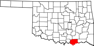
 Location within the U.S. state of Oklahoma | |
 Oklahoma's location within the U.S. | |
| Coordinates: 33°58′N 96°15′W / 33.97°N 96.25°W | |
| Country | |
| State | |
| Founded | 1907 |
| Seat | Durant |
| Largest city | Durant |
| Area | |
• Total | 944 sq mi (2,440 km2) |
| • Land | 904 sq mi (2,340 km2) |
| • Water | 39 sq mi (100 km2) 4.2% |
| Population (2020) | |
• Total | 46,067 |
| • Density | 49/sq mi (19/km2) |
| Time zone | UTC−6 (Central) |
| • Summer (DST) | UTC−5 (CDT) |
| Congressional district | 2nd |
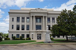
Bryan County is a county in the U.S. state of Oklahoma. As of the 2020 census, the population was 46,067.[1] Its county seat is Durant.[2] It is the only county in the United States named for Democratic politician William Jennings Bryan.
Bryan County comprises the Durant, OK micropolitan statistical area, which is part of the Dallas-Fort Worth and the Texoma region, TX-OK combined statistical area. The city of Durant has the headquarters of the Choctaw Nation of Oklahoma.
Bryan County consists of 10 Townships: Albany, Bennington, Bokchito, Brown, Caddo, Calera, Colbert, Kemp, Matoy, and Speairs.[3]
- ^ "Bryan County, Oklahoma". United States Census Bureau. Retrieved May 9, 2023.
- ^ "Find a County". National Association of Counties. Archived from the original on May 31, 2011. Retrieved June 7, 2011.
- ^ Oklahoma Townships