Back كاپ كليار ARZ Cléire Breton Oileán Chléire Catalan Clear Island (pulo sa Irland) CEB Cape Clear Island German Cléire Basque Clear Island French Cléire Irish Cleareiland Dutch Clear Island NN
Native name: Cléire | |
|---|---|
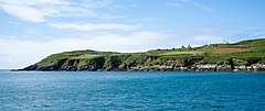
 View from the island's South Harbour | |
| Geography | |
| Location | Carbery's Hundred Isles |
| Coordinates | 51°26′N 9°30′W / 51.433°N 9.500°W |
| Area | 6.7 km2 (2.6 sq mi) |
| Length | 5.2 km (3.23 mi) |
| Width | 2.4 km (1.49 mi) |
| Highest elevation | 160 m (520 ft) |
| Highest point | Cnoicín an tSeabhaic |
| Administration | |
Ireland | |
| Province | Munster |
| County | Cork |
| Barony | Carbery West |
| Demographics | |
| Population | 110 (2022)[1] |
| Pop. density | 18.6/km2 (48.2/sq mi) |
| Additional information | |
| Official website | capeclearisland |
| The island is a Gaeltacht | |
Clear Island or Cape Clear Island (officially known by its Irish name: Cléire, and sometimes also called Oileán Chléire)[2][3] is an island off the south-west coast of County Cork in Ireland. It is the southernmost inhabited part of Ireland and had a population of 110 people as of the 2022 census.[4]
The island is a Gaeltacht area (Irish-speaking area),[5] in which Irish is spoken on a daily basis. The nearest neighbouring island is Sherkin Island, which is 2 kilometres (1 nautical mile) east of Cape Clear Island.
The island is divided into east and west halves by an isthmus called the Waist, with the North Harbour to the landward side and the South Harbour on the seaward side.[6] Ferries sail regularly from the North Harbour to Schull and Baltimore on the mainland. The South Harbour is a popular berth for yachts and pleasure boats during the summer months.
- ^ Population of Inhabited Islands Off the Coast (Report). Central Statistics Office. 2023. Retrieved 29 June 2023.
- ^ "Cléire / Clear Island (island or archipelago, civil parish)". logainm.ie. Irish Placenames Commission. Retrieved 16 October 2019.
- ^ "Cléire / Cape Clear (electoral district)". logainm.ie. Irish Placenames Commission. Retrieved 16 October 2019.
- ^ "Interactive Data Visualisations | CSO Ireland". visual.cso.ie. Retrieved 29 November 2023.
- ^ "Irish Language and the Gaeltacht - CSO - Central Statistics Office". www.cso.ie. Retrieved 29 November 2023.
- ^ David Walsh, Oileáin: A Guide to the Irish Islands (Pesda Press, 2004; ISBN 0953195694), p. 64.
