Back كارديجان ARZ Кардиган Bulgarian Aberteifi Breton Aberteifi Catalan Cardigan (kapital sa komunidad) CEB Aberteifi Welsh Cardigan (Ceredigion) Danish Cardigan (Wales) German Cardigan (Gales) Spanish Cardigan Estonian
Cardigan
| |
|---|---|
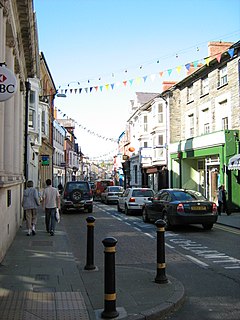
 High Street, Cardigan | |
Location within Ceredigion | |
| Population | 4,216 (2021)[1] |
| OS grid reference | SN175465 |
| Principal area | |
| Preserved county | |
| Country | Wales |
| Sovereign state | United Kingdom |
| Post town | CARDIGAN |
| Postcode district | SA43 |
| Dialling code | 01239 |
| Police | Dyfed-Powys |
| Fire | Mid and West Wales |
| Ambulance | Welsh |
| UK Parliament | |
| Senedd Cymru – Welsh Parliament | |
Cardigan (Welsh: Aberteifi, pronounced [abɛrˈtei̯vi] )[2] is a town and community in the county of Ceredigion, Wales.[3] Positioned on the tidal reach of the River Teifi at the point where Ceredigion meets Pembrokeshire, Cardigan was the county town of the historic county of Cardiganshire. Cardigan is the second-largest town in Ceredigion. The largest town, Aberystwyth, is one of the two administrative centres; the other is Aberaeron.
The settlement at Cardigan was developed around the Norman castle built in the late 11th or early 12th century. The castle was the location of the 1176 Cardigan eisteddfod, precursor of the present-day National Eisteddfod. The town became an important port in the 18th century, but declined by the early 20th century owing to its shallow harbour.[3] The castle underwent restoration in 2014.
The population in 2001 was 4,203, reducing slightly to 4,184 at the 2011 census.
- ^ "Town population 2011". Archived from the original on 18 May 2015. Retrieved 10 May 2015.
- ^ Baynes, T. S., ed. (1878), , Encyclopædia Britannica, vol. 5 (9th ed.), New York: Charles Scribner's Sons, p. 95
- ^ a b EB (1878).

