Back Catsfield (lungsod) CEB Catsfield Welsh Catsfield Spanish Catsfield French Catsfield Italian Catsfield LLD Catsfield Dutch Catsfield Polish Catsfield Swedish Catsfield Turkish
| Catsfield | |
|---|---|
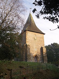
 St Laurence Church | |
Location within East Sussex | |
| Area | 12.2 km2 (4.7 sq mi) [1] |
| Population | 891 (2011)[2] |
| • Density | 177/sq mi (68/km2) |
| OS grid reference | TQ725136 |
| • London | 49 miles (79 km) NNW |
| District | |
| Shire county | |
| Region | |
| Country | England |
| Sovereign state | United Kingdom |
| Post town | BATTLE |
| Postcode district | TN33 |
| Dialling code | 01424 |
| Police | Sussex |
| Fire | East Sussex |
| Ambulance | South East Coast |
| UK Parliament | |
Catsfield is a village and civil parish in the Rother district of East Sussex, England. It is located six miles (9.7 km) north of Bexhill, and three miles (5 km) southwest of Battle.
The village was first documented in the Domesday Book of 1086 where it was recorded "there is a little church serving the hall". It is one of the oldest settlements in the area, with Romano British period archaeological remains.
The village once consisted of two manors: Catsfield and Catsfield Levett. Thomas Lyvet (Levett) held the lordship of the manor of Catsfield in 1445 but forfeited it, along with the lordship of Firle, for his debts. But the manor of Catsfield Levett remained in the Levett family for centuries, and in the seventeenth century a Levett heiress carried it into the Eversfield family. (Richard Lyvet of Firle was lord of the manor of Catsfield in 1431.) With a fortune built on ancestral landholdings and later on iron making, the Levetts held land across Sussex. The parish church is dedicated to St Laurence.[3]
Catsfield is located in the Sussex Weald within the designated landscape the High Weald Area of Outstanding Natural Beauty.
- ^ "East Sussex in Figures". East Sussex County Council. Retrieved 26 April 2008.
- ^ "Civil Parish population 2011". Retrieved 6 October 2015.
- ^ Photos of the church
