Back চেন্নাই মহানগর অঞ্চল Bengali/Bangla Àrea Metropolitana de Chennai Catalan Metropolregion Chennai German ᱪᱮᱱᱱᱟᱭ ᱢᱟᱦᱟᱱᱚᱜᱚᱨ ᱴᱚᱴᱷᱟ SAT சென்னை மாநகர பரப்பு Tamil చెన్నై మెట్రోపాలిటన్ ప్రాంతం Tegulu
Greater Chennai
Chennai Metropolitan Area | |
|---|---|
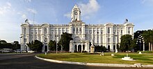
 Chennai skyline | |
| Nickname(s): | |
 CMA expanded boundary | |
| Country | India |
| State | Tamil Nadu |
| Core city | Chennai |
| Districts | |
| Area | |
| • Urban | 932.47 km2 (360.03 sq mi) |
| • Metro | 5,904 km2 (2,280 sq mi) |
| • City [2] | 426 km2 (164 sq mi) |
| Population (2011) | |
| • Estimate (2024)[3] | |
| • Rank | 4 |
| • Urban | 8,653,521 |
| • Urban density | 9,300/km2 (24,000/sq mi) |
| • Metro | 12,288,000 |
| • Metro density | 2,100/km2 (5,400/sq mi) |
| • City | 6,748,026 |
| • City density | 16,000/km2 (41,000/sq mi) |
| Demonym(s) | Chennaivasi, Chennaiite |
| Time zone | UTC+5:30 (Indian Standard Time) |
| GDP (PPP) (2019-20) | |
| Website | www |
| Area note: Area of CMA was expanded from 1189 sq.km to 5904 sq.km in 2022.[6] Population note: As per the 2011 census, population corresponding to the pre-expansion limits was about 8.9 million.[7] The population estimate corresponding to the post-expansion limits was given as 12.28 million (based on the 2011 census) by CMDA.[8] | |
Greater Chennai Metropolitan Area, or simply the Chennai Metropolitan Area (CMA), is fourth-most populous metropolitan area in India and the 35th most populous in the world.

The CMA consists of the core city of Chennai, which is coterminous with the Chennai district, and its suburbs in Kanchipuram, Chengalpattu, Thiruvallur and Ranipet districts contributes to 26% of States GDP.

The Chennai Metropolitan Development Authority (CMDA) is the nodal agency that handles town planning and development within the metro area. In 1974, an area encompassing 1,189 km2 (459 sq mi) around the city was designated as the metropolitan area which was subsequently expanded to 5,904 km2 (2,280 sq mi) in 2022.

Oxford Economics Global Cities Index 2024 ranked Chennai as the 4th best city in India and 472nd best city in the world.[9]
- ^ Census of India "https://censusindia.gov.in/nada/index.php/catalog/42876/download/46544/CLASS_I.xlsx"
- ^ https://chennai.nic.in/
- ^ {Delhi, Mumbai or Kolkata?: Here are top 10 most populated Indian cities in 2024}{url="https://indianexpress.com/article/trending/top-10-listing/delhi-mumbai-or-kolkata-here-are-top-10-densely-populated-indian-cities-in-2024-9446056/"}
- ^ {Census of India 2011 } {https://censusindia.gov.in/nada/index.php/catalog/42876/download/46544/CLASS_I.xlsx}
- ^ https://urbanemissions.info/india-apna/chennai-india/
- ^ "Chennai Metropolitan Development Authority". Government of Tamilnadu. Retrieved 9 July 2017.
- ^ "About CMA". Chennai Metropolitan Development Authority. Retrieved 1 June 2024.
- ^ Chennai Metropolitan Development Authority [@CMDA_Official] (26 February 2024). "Population of Chennai Metropolitan Area" (Tweet) – via Twitter.
- ^ "Global Cities Index". Oxford Economics. Retrieved 12 August 2024.