Back تشيسابيك (أوهايو) Arabic تشيسابيك ARZ چساپیک، اوهایو AZB Chesapeake (Ohio) Catalan Chesapeake (lungsod sa Tinipong Bansa, Ohio) CEB Chesapeake, Ohio Welsh Chesapeake (Ohio) German Chesapeake (Ohio) Spanish Chesapeake (Ohio) Basque چساپیک، اوهایو Persian
Chesapeake, Ohio | |
|---|---|
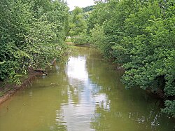
 Symmes Creek at its mouth | |
 Location of Chesapeake, Ohio | |
 Location of Chesapeake in Lawrence County | |
| Coordinates: 38°25′41″N 82°27′23″W / 38.42806°N 82.45639°W | |
| Country | United States |
| State | Ohio |
| County | Lawrence |
| Township | Union |
| Government | |
| • Type | Mayor-council government |
| • Mayor | Drew Griffin |
| Area | |
• Total | 0.56 sq mi (1.45 km2) |
| • Land | 0.47 sq mi (1.23 km2) |
| • Water | 0.09 sq mi (0.22 km2) |
| Elevation | 558 ft (170 m) |
| Population | |
• Total | 765 |
• Estimate (2023)[4] | 729 |
| • Density | 1,613.92/sq mi (623.70/km2) |
| Time zone | UTC-5 (Eastern (EST)) |
| • Summer (DST) | UTC-4 (EDT) |
| ZIP code | 45619 |
| Area code | 740 |
| FIPS code | 39-13904[5] |
| GNIS feature ID | 2397614[2] |
Chesapeake is a village in Lawrence County, Ohio, United States. The population was 765 as of the 2020 census. It lies across the Ohio River from Huntington, West Virginia, at the mouth of Symmes Creek.
The Robert C. Byrd Bridge across the Ohio River connects Chesapeake to Huntington's downtown area. At one time, this was the only bridge connection across the Ohio River linking Ohio to Huntington. In recent years, bridges across the Ohio River connecting Ohio to Huntington's East and West sides have been built.
Chesapeake is a part of the Huntington-Ashland, WV-KY-OH, Metropolitan Statistical Area (MSA).
- ^ "ArcGIS REST Services Directory". United States Census Bureau. Retrieved September 20, 2022.
- ^ a b U.S. Geological Survey Geographic Names Information System: Chesapeake, Ohio
- ^ "Chesapeake village, Ohio - Census Bureau Profile". United States Census Bureau. Retrieved June 10, 2024.
- ^ "Annual Estimates of the Resident Population for Incorporated Places in Ohio: April 1, 2020 to July 1, 2023". United States Census Bureau. Retrieved June 10, 2024.
- ^ "U.S. Census website". United States Census Bureau. Retrieved January 31, 2008.