Back ایستگاه راهآهن کلاپام های استریت Persian Stazione di Clapham High Street Italian Stazion de Clapham High Street LMO Station Clapham High Street Dutch Клепгем-хай-стріт (станція) Ukrainian کلیپہم ہائی اسٹریٹ ریلوے اسٹیشن Urdu קלאפהאם היי סטריט באן סטאנציע YI 克拉珀姆高街站 Chinese
| Clapham High Street | |
|---|---|
 | |
| Location | Clapham |
| Local authority | London Borough of Lambeth |
| Managed by | London Overground |
| Station code(s) | CLP |
| DfT category | F1 |
| Number of platforms | 2 |
| Fare zone | 2 |
| OSI | Clapham North |
| National Rail annual entry and exit | |
| 2018–19 | |
| 2019–20 | |
| 2020–21 | |
| 2021–22 | |
| 2022–23 | |
| Railway companies | |
| Original company | London, Chatham and Dover Railway |
| Post-grouping | Southern Railway |
| Key dates | |
| 25 August 1862 | Opened (LCDR) |
| 1 May 1867 | Opened (LBSCR) |
| 3 April 1916 | Closed (LCDR) |
| Other information | |
| External links | |
| Coordinates | 51°27′57″N 0°07′58″W / 51.4658°N 0.1328°W |
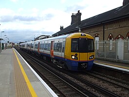
Clapham High Street railway station is on the South London line in Clapham, within the London Borough of Lambeth, Greater London. It is 6 miles 21 chains (10.1 km) measured from London Bridge (the former LC&DR platforms also being 2 miles 25 chains (3.7 km) measured from London Victoria).[3] It is served by London Overground services between Clapham Junction and Dalston Junction, with a limited service to Battersea Park. Southeastern services from Lewisham pass through the station, however proposals to call at the station have been limited by the age of Southeastern’s rolling stock.
It is close to Clapham North tube station, and interchange between the two is counted as an Out of Station Interchange on Oyster, so that users are charged for only one journey, rather than two separate journeys.[4]
- ^ "Out of Station Interchanges" (XLSX). Transport for London. 16 June 2020. Retrieved 5 November 2020.
- ^ a b c d e "Estimates of station usage". Rail statistics. Office of Rail Regulation. Please note: Some methodology may vary year on year.
- ^ Yonge, John (November 2008) [1994]. Jacobs, Gerald (ed.). Railway Track Diagrams 5: Southern & TfL (3rd ed.). Bradford on Avon: Trackmaps. map2R. ISBN 978-0-9549866-4-3.
- ^ "Out of Station Interchange (OSI)". Oyster and National Rail (independent guide). 26 May 2010. Retrieved 31 May 2010.
