Back Klaydbank Azerbaijani کلایدبنک AZB Clydebank Catalan Clydebank CEB Clydebank Czech Clydebank Welsh Clydebank Danish Clydebank German Clydebank Esperanto Clydebank Spanish
Clydebank
| |
|---|---|
| Town | |
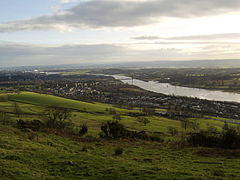
 View of Clydebank from Kilpatrick Hills | |
| Area | 8.74 km2 (3.37 sq mi) [2] |
| Population | 25,620 (2022)[3] |
| • Density | 2,931/km2 (7,590/sq mi) |
| OS grid reference | NS500700 |
| • Edinburgh | 47 mi (76 km) |
| • London | 350 mi (560 km) |
| Lieutenancy area | |
| Country | Scotland |
| Sovereign state | United Kingdom |
| Post town | CLYDEBANK |
| Postcode district | G81 |
| Dialling code | 0141 & 01389 |
| Police | Scotland |
| Fire | Scottish |
| Ambulance | Scottish |
| UK Parliament | |
| Scottish Parliament | |
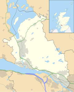
Clydebank (Scottish Gaelic: Bruach Chluaidh) is a town in West Dunbartonshire, Scotland. Situated on the north bank of the River Clyde, it borders the village of Old Kilpatrick (with Bowling and Milton beyond) to the west, and the Yoker and Drumchapel areas of the adjacent City of Glasgow immediately to the east. Depending on the definition of the town's boundaries, the suburban areas of Duntocher, Faifley and Hardgate either surround Clydebank to the north, or are its northern outskirts, with the Kilpatrick Hills beyond.
Historically part of Dunbartonshire and founded as a police burgh on 18 November 1886, Clydebank is part of the registration County of Dumbarton, the Dunbartonshire Crown Lieutenancy area, and the wider urban area of Greater Glasgow.[4]
- ^ "StackPath". www.ainmean-aite.org. Archived from the original on 15 April 2021. Retrieved 15 June 2011.
- ^ "Clydebank (West Dunbartonshire, Scotland) – Population Statistics, Charts, Map, Location, Weather and Web Information". www.citypopulation.de. Retrieved 14 April 2019.
- ^ "Mid-2020 Population Estimates for Settlements and Localities in Scotland". National Records of Scotland. 31 March 2022. Retrieved 31 March 2022.
- ^ "Table KS01: Usual resident population (by locality)" (PDF). 2001 Census: Key Statistics for Settlements and Localities Scotland. General Register Office for Scotland. Archived from the original (PDF) on 25 November 2010. Retrieved 6 February 2010.


