Back مقاطعة كواهوما (ميسيسيبي) Arabic Coahoma County, Mississippi BAR Коахома (окръг, Мисисипи) Bulgarian কোৱাহোমা কাউন্টি, মিসিসিপি BPY Coahoma Gông (Mississippi) CDO Коэхома (гуо, Миссисипи) CE Coahoma County CEB Coahoma County, Mississippi Welsh Coahoma County Danish Coahoma County German
Coahoma County | |
|---|---|
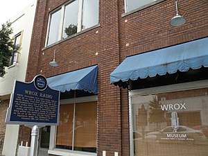
 Original WROX (AM) building in Clarksdale. | |
 Location within the U.S. state of Mississippi | |
 Mississippi's location within the U.S. | |
| Coordinates: 34°14′N 90°36′W / 34.23°N 90.6°W | |
| Country | |
| State | |
| Founded | February 9, 1836 |
| Seat | Clarksdale |
| Largest city | Clarksdale |
| Area | |
• Total | 583 sq mi (1,510 km2) |
| • Land | 552 sq mi (1,430 km2) |
| • Water | 31 sq mi (80 km2) 5.3% |
| Population (2020) | |
• Total | 21,390 |
| • Density | 37/sq mi (14/km2) |
| Time zone | UTC−6 (Central) |
| • Summer (DST) | UTC−5 (CDT) |
| Congressional district | 2nd |
| Website | www |

Coahoma County is a county located in the U.S. state of Mississippi. As of the 2020 census, the population was 21,390.[1] Its county seat is Clarksdale.[2]
The Clarksdale, MS Micropolitan Statistical Area includes all of Coahoma County. It is located in the Mississippi Delta region of Mississippi. In 2023, the Clarksdale, Mississippi Micropolitan area was added to form the new Memphis-Clarksdale-Forrest City Combined Statistical Area.[3] The Memphis-Clarksdale-Forrest City Combined Statistical Area has a population of roughly 1.4 million.
- ^ "Census - Geography Profile: Coahoma County, Mississippi". United States Census Bureau. Retrieved January 8, 2023.
- ^ "Find a County". National Association of Counties. Archived from the original on May 31, 2011. Retrieved June 7, 2011.
- ^ https://www.whitehouse.gov/wp-content/uploads/2023/07/OMB-Bulletin-23-01.pdf [bare URL PDF]