| Coquimbo Formation | |
|---|---|
| Stratigraphic range: Miocene–Mid Pleistocene ~ | |
 Marine terrace exposing strata of the Coquimbo Formation, at Caleta Hornos | |
| Type | Geological formation |
| Underlies | Alluvium |
| Overlies | Liman Formation |
| Thickness | 63 m (207 ft) |
| Lithology | |
| Primary | Conglomerate, sandstone, siltstone, shale and coquina |
| Other | Clay lenses, terra rossa |
| Location | |
| Coordinates | 30°20′21″S 71°32′03″W / 30.33917°S 71.53417°W |
| Approximate paleocoordinates | 30°06′S 70°18′W / 30.1°S 70.3°W |
| Region | Coquimbo Region |
| Country | |
| Extent | Tongoy Bay |
| Type section | |
| Named for | Coquimbo |
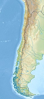
Coquimbo Formation (Spanish: Formación Coquimbo) is a Miocene to Middle Pleistocene sedimentary formation located in Coquimbo Region in Norte Chico, Chile. The lowermost unit belongs to the lower Miocene, with the third-deepest unit dated at 11.9 ± 1.0 Ma. The uppermost unit of the formation is estimated at 1.2 Ma. In the area of Tongoy, the Coquimbo Formation was deposited in an ancient bay that was formed in a graben or half-graben, with a normal fault dipping east. Sea level changes during the Holocene have caused erosion to cut several marine terraces into the formation.[1]
- ^ Le Roux, J.P.; Olivares, Danisa M.; Nielsen, Sven N.; Smith, Norman D.; Middleton, Heather; Fenner, Juliane; Ishman, Scott E. (2006). "Bay sedimentation as controlled by regional crustal behaviour, local tectonics and eustatic sea-level changes: Coquimbo Formation (Miocene–Pliocene), Bay of Tongoy, central Chile" (PDF). Sedimentary Geology. 184 (1–2): 133–153. Bibcode:2006SedG..184..133L. doi:10.1016/j.sedgeo.2005.09.023. Retrieved 11 April 2016.

