Back Cordillera Central (Luzon) BCL Cordillera Central Mountains CEB کۆردیلێرای ناوەندی (لوزۆن) CKB Cordillera Central (Philippinen) German Cordillera Central (Filipinas) Spanish Cordillère Centrale (Luçon) French कोर्दिल्येरा सेन्ट्रल (लूज़ोन) Hindi Kordiliera Sentral (Luzon) ILO Cordigliera centrale (Luzon) Italian 中央山岳地帯 Japanese
| Cordillera Central | |
|---|---|
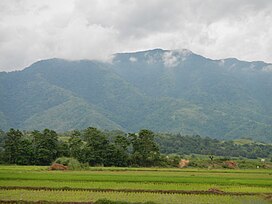
 The southern limits of the range as viewed from the plains of Natividad, Pangasinan | |
| Highest point | |
| Peak | Mount Pulag |
| Elevation | 2,928[1] m (9,606 ft) |
| Dimensions | |
| Length | 320 km (200 mi) north-south |
| Width | 118 km (73 mi) east-west |
| Area | 22,500 km2 (8,700 sq mi) |
| Geography | |
| Country | Philippines |
| Provinces | |
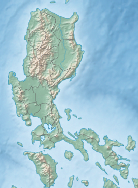
| Range coordinates | 17°20′N 120°57′E / 17.333°N 120.950°E |
The Cordillera Central or Cordillera Range is a massive mountain range 320 kilometres (200 mi) long north–south and 118 kilometres (73 mi) east-west situated in the north-central part of the island of Luzon, in the Philippines. The mountain range encompasses all provinces of the Cordillera Administrative Region (Abra, Apayao, Benguet, Ifugao, Kalinga and Mountain Province), as well as portions of eastern Ilocos Norte, eastern Ilocos Sur, eastern La Union, northeastern Pangasinan, western Nueva Vizcaya, and western Cagayan.
To the north, the mountain range terminates at the northern shores of Luzon along the Babuyan Channel in Ilocos Norte and Cagayan provinces.[2] At its southeastern part, the Central Cordillera is linked to the Sierra Madre Mountains, the longest mountain range in the country, through the Caraballo Mountains in Nueva Vizcaya province. During Spanish colonial period, the whole range was called Nueva Provincia (New Province).[3]
- ^ Cite error: The named reference
PHIVOLCSwas invoked but never defined (see the help page). - ^ U.S. Army Corps of Engineer (1953). Laoag, Philippines (Topography map). Retrieved September 26, 2014 – via University of Texas in Austin Library.
- ^ Hicks, Nigel (2007). The Philippines (3rd ed.). London: New Holland. p. 51. ISBN 978-1-84537-662-8.

