Back كورا (جلينلوجان) ARZ Cowra (lungsod) CEB Cowra German Cowra Esperanto کاورا Persian Cowra French Cowra Irish カウラ Japanese 카우라 Korean Cowra Malagasy
| Cowra New South Wales | |||||||||
|---|---|---|---|---|---|---|---|---|---|
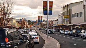
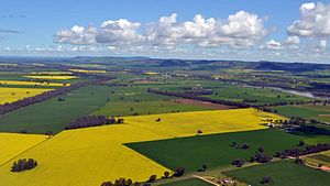
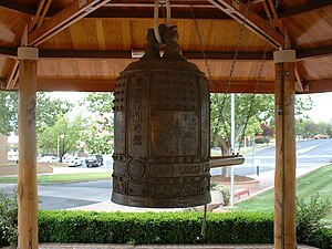
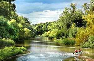
From top to bottom, left to right: Kendal Street divides the CBD; the Eastern entrance to the town, near Europa Park; Crops of canola creating fields of gold;Australia's World Peace Bell proudly housed in Cowra's Civic Square; and the Lachlan River which flows through the heart of the town | |||||||||
| Coordinates | 33°50′02″S 148°42′00″E / 33.83389°S 148.70000°E | ||||||||
| Population | 9,863 (2016 census)[1] | ||||||||
| Established | 1846 | ||||||||
| Gazetted | 1849 | ||||||||
| Postcode(s) | 2794 | ||||||||
| Elevation | 310 m (1,017 ft) | ||||||||
| Time zone | AEST (UTC+10) | ||||||||
| • Summer (DST) | AEDT (UTC+11) | ||||||||
| Location | |||||||||
| LGA(s) | Cowra Shire | ||||||||
| County | Forbes, Bathurst | ||||||||
| State electorate(s) | Cootamundra | ||||||||
| Federal division(s) | Riverina | ||||||||
| |||||||||
Cowra (/ˈkaʊrə/)[6] is a small town in the Central West region of New South Wales, Australia. It is the largest population centre and the council seat for the Cowra Shire, with a population of 9,863.[1]
Cowra is located approximately 310 m (1,017 ft) above sea level, on the banks of the Lachlan River, in the Lachlan Valley. By road it is approximately 310 km (193 mi) west[7] of the state capital, Sydney, and 189 km (117 mi) north of the nation's capital, Canberra.[8] The town is situated at the intersection of three state highways: the Mid-Western Highway, Olympic Highway, and the Lachlan Valley Way.
Cowra is included in the rainfall recorder and weather forecast region for the Central West Slopes and Plains division of the Bureau of Meteorology forecasts.[9]
- ^ a b Australian Bureau of Statistics (27 June 2017). "Cowra (State Suburb)". 2016 Census QuickStats. Retrieved 1 December 2018.
 Material was copied from this source, which is available under a Creative Commons Attribution 4.0 International License.
- ^ "Great Circle Distance between ORANGE and COWRA". Geosciences Australia website. Commonwealth of Australia. Archived from the original on 20 October 2012. Retrieved 16 August 2011.
- ^ "Great Circle Distance between BATHURST and COWRA". Geosciences Australia website. Commonwealth of Australia. Archived from the original on 15 June 2013. Retrieved 16 August 2011.
- ^ "Great Circle Distance between CANBERRA and COWRA". Geosciences Australia website. Commonwealth of Australia. Archived from the original on 20 October 2012. Retrieved 16 August 2011.
- ^ "Great Circle Distance between SYDNEY and COWRA". Geosciences Australia website. Commonwealth of Australia. Archived from the original on 20 October 2012. Retrieved 16 August 2011.
- ^ "Cowra". Australian Oxford Dictionary (2nd ed.). Oxford University Press. 2004. ISBN 0-19-551796-2.
- ^ "Cowra to Sydney".
- ^ Google Maps @ (34.4464296,147.639039)
- ^ Central West Slopes and Plains Australian Government Bureau of Meteorology


