Back Cuxhaven Afrikaans كوكسهافن Arabic كوكسهاڤين ARZ کوکسهاون AZB Куксхафен Bashkir Куксгафен Byelorussian Cuxhaven Breton Cuxhaven Catalan Куксхафен CE Cuxhaven (munisipyo) CEB
This article needs additional citations for verification. (January 2013) |
Cuxhaven
Cuxhoben (Low German) | |
|---|---|
 Kugelbake, symbol of Cuxhaven | |
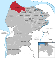
Location of Cuxhaven within Cuxhaven district  | |
| Coordinates: 53°51′40″N 08°41′40″E / 53.86111°N 8.69444°E | |
| Country | Germany |
| State | Lower Saxony |
| District | Cuxhaven |
| Government | |
| • Lord mayor (2019–24) | Uwe Santjer[1] (SPD) |
| Area | |
| • Total | 161.91 km2 (62.51 sq mi) |
| Elevation | 2 m (7 ft) |
| Population (2022-12-31)[2] | |
| • Total | 48,562 |
| • Density | 300/km2 (780/sq mi) |
| Time zone | UTC+01:00 (CET) |
| • Summer (DST) | UTC+02:00 (CEST) |
| Postal codes | 27472, 27474, 27476, 27478 |
| Dialling codes | 04721-04724 |
| Vehicle registration | CUX |
| Website | www.cuxhaven.de |
Cuxhaven (German: [kʊksˈhaːfn̩]; Low German: Cuxhoben) is a town and seat of the Cuxhaven district, in Lower Saxony, Germany. The town includes the northernmost point of Lower Saxony. It is situated on the shore of the North Sea at the mouth of the Elbe River.[3] Cuxhaven has a footprint of 14 kilometres (9 miles) (east–west) by 7 km (4 mi) (north–south). Its town quarters Duhnen, Döse and Sahlenburg are especially popular vacation spots on the North Sea and home to about 52,000 residents.
Cuxhaven is home to an important fisherman's wharf and ship registration point for Hamburg as well as the Kiel Canal until 2008. Tourism is also of great importance. The city and its precursor Ritzebüttel belonged to Hamburg from the 13th century until 1937. The island of Neuwerk, a Hamburg dependency, is located just northwest of Cuxhaven in the North Sea. The city's symbol, known as the Kugelbake, is a beacon once used as a lighthouse; the wooden landmark on the mouth of the Elbe marks the boundary between the river and the North Sea and also adorns the city's coat of arms.
- ^ "Verzeichnis der direkt gewählten Bürgermeister/-innen und Landräte/Landrätinnen". Landesamt für Statistik Niedersachsen. April 2021.
- ^ "LSN-Online Regionaldatenbank, Tabelle A100001G: Fortschreibung des Bevölkerungsstandes, Stand 31. Dezember 2022" (in German). Landesamt für Statistik Niedersachsen.
- ^ Chisholm, Hugh, ed. (1911). . Encyclopædia Britannica. Vol. 7 (11th ed.). Cambridge University Press. p. 677.


