Back مقاطعة كاياهوغا (أوهايو) Arabic کویاهوقا بؤلگهسی، اوهایو AZB Cuyahoga County, Ohio BAR Каяхога (окръг, Охайо) Bulgarian কুয়াহোগা কাউন্টি, ওহাইও BPY Comtat de Cuyahoga Catalan Cuyahoga Gông (Ohio) CDO Cuyahoga County CEB Cuyahoga County, Ohio Welsh Cuyahoga County Danish
Cuyahoga County | |
|---|---|
 | |
| Etymology: Cuyahoga River | |
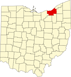
 Map of Cuyahoga County within Ohio | |
| Coordinates: 41°32′24″N 81°39′36″W / 41.54000°N 81.66000°W | |
| Country | United States |
| State | Ohio |
| Region | Northeast Ohio |
| Founded | May 1, 1810 |
| Named for | Cuyahoga River |
| County seat | Cleveland |
| Government | |
| • County Executive | Chris Ronayne (D) |
| Area | |
| • Total | 1,246 sq mi (3,230 km2) |
| • Land | 457 sq mi (1,180 km2) |
| • Water | 788 sq mi (2,040 km2) |
| Elevation | 653 ft (199 m) |
| Population (2020) | |
| • Total | 1,264,817 |
| • Estimate (2023) | 1,233,088 |
| • Density | 2,768/sq mi (1,069/km2) |
| Gross Domestic Product | |
| • Total | US$104.292 billion (2022) |
| Time zone | UTC−5 (EST) |
| • Summer (DST) | UTC−4 (EDT) |
| Area code | 216 |
| Congressional districts | 7th, 11th |
| Largest city | Cleveland |
| Website | www |
Cuyahoga County (/ˌkaɪ.əˈhɒɡə/ KY-ə-HOG-ə or /ˌkaɪ.əˈhoʊɡə/ KY-ə-HOH-gə)[2][3][4][5] is a large urban county located in the northeastern part of the U.S. state of Ohio. The county seat and largest city is Cleveland.[6] As of the 2020 census, its population was 1,264,817, making it the second-most populous county in the state.[7]
Cuyahoga County is situated on the southern shore of Lake Erie, across the U.S.–Canada maritime border. The county is bisected by the Cuyahoga River, after which it was named. "Cuyahoga" is an Iroquoian word meaning "crooked river".[8] It is the core county of the Cleveland, OH Metropolitan Statistical Area and Cleveland–Akron–Canton, OH Combined Statistical Area.
- ^ "Gross Domestic Product by County and Metropolitan Area, 2022" (PDF). www.bea.gov. Bureau of Economic Analysis.
- ^ Feran, Tom (February 13, 2004). "Shooing the hog out of Cuyahoga". The Plain Dealer.
- ^ Feran, Tom (June 2, 2006). "It's a Cleveland thing, so to speak". The Plain Dealer.
- ^ Siegel, Robert; Block, Melissa (June 23, 2009). "Letters: Cuyahoga River". All Things Considered. National Public Radio. Retrieved June 23, 2009.
- ^ McIntyre, Michael K. (June 28, 2009). "How to pronounce 'Cuyahoga' turns into a national debate: Tipoff". The Plain Dealer. Retrieved June 29, 2009.
- ^ "Find a County". National Association of Counties. Archived from the original on May 31, 2011. Retrieved June 7, 2011.
- ^ "State & County QuickFacts". United States Census Bureau. Retrieved September 6, 2023.
- ^ "Cuyahoga County data". Ohio State University Extension Data Center. Archived from the original on November 6, 2007. Retrieved April 28, 2007.

