Back إقليم دار السلام Arabic TanzaniaDarEsSalaamGola AVK Дар-эс-Салам (вобласць) Byelorussian Дар ес Салаам (регион) Bulgarian Regió de Dar es Salaam Catalan Dar es Salaam Region CEB Dar-es-Salaam (region) Danish Daressalam (Region) German Περιφέρεια Νταρ ες Σαλάαμ Greek Regiono Daresalamo Esperanto
Dar es Salaam
Mkoa wa Dar es Salaam | |
|---|---|
|
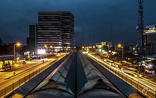
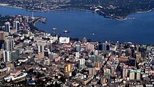
From top to bottom: Dar Rapid Bus Transit System, National Museum of Tanzania, & Bird's eye view of Dar es Salaam | |
| Nickname(s): The brain of Tanzania, Bongo | |
 Location in Tanzania | |
| Coordinates: 6°47′32.64″S 39°12′29.88″E / 6.7924000°S 39.2083000°E | |
| Country | |
| Zone | Coastal |
| Named for | City of Dar es Salaam |
| Capital | Dar es Salaam |
| Districts | |
| Government | |
| • Regional Commissioner | Amos Makalla |
| Area | |
| • Total | 1,393 km2 (538 sq mi) |
| • Rank | 26th of 31 |
| Highest elevation (Pande Hill) | 192 m (630 ft) |
| Population (2022) | |
| • Total | 5,383,728 |
| • Rank | 1st of 31 |
| • Density | 3,900/km2 (10,000/sq mi) |
| Demonym | Darlite |
| Ethnic groups | |
| • Settler | Swahili |
| • Native | Zaramo |
| Time zone | UTC+3 (EAT) |
| Postcode | 11xxx |
| Area code | 026 |
| ISO 3166 code | TZ-02 |
| HDI (2021) | 0.653[1] medium · 2nd |
| Website | dsm |
| Symbols of Tanzania | |
| Bird | |
| Butterfly | |
| Fish | |
| Mammal | Dar es Salaam Pipistrelle |
| Tree |  |
| Mineral |  |
Dar es Salaam Region (Mkoa wa Dar es Salaam in Swahili) is one of Tanzania's 31 administrative regions and is located in the east coast of the country. The region covers an area of 1,393 km2 (538 sq mi).[2] The region is comparable in size to the combined land and water areas of the nation state of Mauritius.[3] Dar es Salaam Region is bordered to the east by Indian Ocean and it is entirely surrounded by Pwani Region. The Pwani districts that border Dar es Salaam region are Bagamoyo District to the north, Kibaha Urban District to the west, Kisarawe District to the south west and Mkuranga District to the south of the region. The region's seat (capital) is located inside the ward of Ilala. The region is named after the city of Dar es Salaam itself. The region is home to Tanzania's major finance, administration and industries, thus the making it the country's richest region. The region also has the second highest Human Development Index in the country after Mjini Magharibi.[1] According to the 2022 census, the region has a total population of 5,383,728.[4] The region has the highest population in Tanzania followed by Mwanza Region.[5]
- ^ a b "Sub-national HDI - Area Database - Global Data Lab". hdi.globaldatalab.org. Retrieved 2020-02-26.
- ^ "Takwimu". dsm.go.tz.
- ^ 2,040 km2 (790 sq mi) for Mauritius at "Area size comparison". Nation master. 2022. Retrieved 7 July 2022.
1,393 km2 (538 sq mi) for Dar es Salaam. - ^ Cite error: The named reference
Census 2012was invoked but never defined (see the help page). - ^ Matokeo ya Mwanzo ya Sensa ya Watu na Makazi (Report). Government of Tanzania. Retrieved 2023-02-02.


