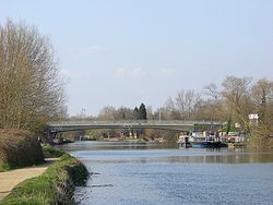
Donnington Bridge | |
|---|---|
 Donnington Bridge, seen from the south. | |
| Coordinates | 51°44′08″N 1°14′31.5″W / 51.73556°N 1.242083°W |
| Crosses | River Thames |
| Locale | Oxford |
| Characteristics | |
| Design | Arch |
| Material | Concrete |
| Width | 56 feet 8 inches (17.27 m) |
| Height | 16 feet 6 inches (5.03 m)[1] |
| Longest span | 170 feet (52 m) |
| No. of spans | 1 |
| History | |
| Designer | Travers Morgan and Partners |
| Opened | 1962 |
| Location | |
 | |

Donnington Bridge is a modern road bridge (completed in 1962) over the River Thames, in the south of the city of Oxford, England. At this point the river is commonly called the Isis. The bridge carries the B4495 road (Donnington Bridge Road) from Abingdon Road to Iffley Road. It crosses the river on the reach between Iffley Lock and Osney Lock.
- ^ River Thames Alliance. Bridge heights on the River Thames.
