Back شرق جودافارى Arabic شرق جودافارى ARZ पूर्ब गोदावरी जिला Bihari পূর্ব গোদাবরী জেলা Bengali/Bangla Districte d'East Godavari Catalan East Godāvari CEB East Godavari (distrikt) Danish East Godavari German Γκοντάβαρι Ανατολικό (νομός) Greek Distrito de Godavari Este Spanish
East Godavari district | |
|---|---|
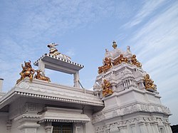
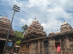
Clockwise from top-left: Kovvur Shivalayam, Golingeshwara Temple near Biccavole,
Godavari bridges near Rajamahendravaram | |
 Location in Andhra Pradesh | |
 Interactive map outlining district | |
| Coordinates: 16°57′N 82°15′E / 16.950°N 82.250°E | |
| Country | |
| State | |
| Region | Coastal Andhra |
| Headquarters | Rajamahendravaram |
| Mandalas | 19[1] |
| Government | |
| • District collector | Dr K Madhavi Latha, IAS[2] |
| • Lok Sabha constituencies | Rajamahendravaram |
| • Assembly constituencies | 7 |
| Area | |
| • Total | 2,560.70 km2 (988.69 sq mi) |
| Population | |
| • Total | 1,832,332 |
| • Density | 720/km2 (1,900/sq mi) |
| Demographics | |
| • Literacy | 71.35% |
| • Sex ratio | 1005 |
| Vehicle registration | AP-05 (former) AP–39 (from 30 January 2019)[5] |
| Major highways | NH 16, NH 216, NH 516E, NH 216A, NH-365BB, NH-516D. |
| Website | eastgodavari |
East Godavari is a district in the Coastal Andhra region of Andhra Pradesh, India. Its district headquarters is at Rajamahendravaram.
In the Madras Presidency, the District of Rajamahendravaram was created in 1823.[6] It was reorganised in 1859 and was bifurcated into Godavari and Krishna districts. During British rule, Rajamahendravaram was the headquarters of Godavari District, which was further bifurcated into East Godavari and West Godavari districts in 1925. When the Godavari district was divided, Kakinada became the headquarters of East Godavari and Eluru became headquarters of West Godavari.[7][8] In November 1956, Andhra Pradesh was formed by merging Andhra State with the Telugu-speaking areas of the Hyderabad State. In 1959, the Bhadrachalam revenue division, consisting of Bhadrachalam and Naguru Taluqs (2 Taluqas in 1959 but later subdivided into Wajedu, Venkatapruram, Charla, Dummugudem, Bhadrachalam, Nellipaka, Chinturu, Kunavaram, and Vara Rama Chandra Puram Mandals) of the East Godavari district were merged into the Khammam district.[9] After June 2014's reorganisation and division of Andhra Pradesh, the mandals of Bhadrachalam (with the exception of Bhadrachalam Temple), Nellipaka, Chinturu, Kunavaram and Vara Rama Chandra Puram were re-added back to the East Godavari district.[10]
- ^ "District – East Godavari". Andhra Pradesh Online Portal. Archived from the original on 18 June 2015. Retrieved 23 August 2014.
- ^ "Collectors, SPs appointed for new districts in Andhra Pradesh". The Hindu. 30 April 2022. Retrieved 30 April 2022.
- ^ Cite error: The named reference
demographicswas invoked but never defined (see the help page). - ^ Cite error: The named reference
demographics1was invoked but never defined (see the help page). - ^ "New 'AP 39&40' code to register vehicles in Andhra Pradesh launched". The New Indian Express. Vijayawada. 31 January 2019. Archived from the original on 3 February 2019. Retrieved 9 June 2019.
- ^ Bhaskar, B. v s (8 June 2014). "Nyapathi Subbarao carved an identity for Telugus". The Hindu – via www.thehindu.com.
- ^ "District Profile". East Godavari District Webportal. National Informatics Centre. Archived from the original on 30 April 2015. Retrieved 8 May 2015.
- ^ Knipe, David M. (2015). Vedic Voices: Intimate Narratives of a Living Andhra Tradition. Oxford University Press. ISBN 9780199397709. Retrieved 8 May 2015.
- ^ Narayana Rao, K. V. (1972). Telangana. Minerva Associates. ISBN 9780883861189.
- ^ "Post division, who will get Bhadrachalam?". The Times of India. 21 August 2013.


