Back غابة اليونكي الوطنية Arabic غابة اليونكى الوطنيه ARZ Bosc nacional El Yunque Catalan El Yunque National Forest CEB Národní les El Yunque Czech El Yunque National Forest German Bosque nacional El Yunque Spanish جنگل ملی الیونک Persian Forêt nationale d'El Yunque French Hutan Nasional El Yunque ID
| El Yunque National Forest | |
|---|---|
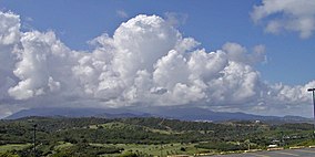
 El Yunque in the far background, as seen from the east | |
| Location | Puerto Rico |
| Nearest city | Río Grande, PR |
| Coordinates | 18°19′N 65°47′W / 18.317°N 65.783°W |
| Area | 28,434 acres (115.07 km2)[1] |
| Established | January 17, 1903 |
| Governing body | U.S. Forest Service |
| Website | http://www.fs.usda.gov/elyunque/ |
El Yunque National Forest (Spanish: Bosque Nacional El Yunque), formerly known as the Caribbean National Forest (or Bosque Nacional del Caribe),[2][3] is a forest located in northeastern Puerto Rico. While there are both temperate and tropical rainforests in other states and territories, it is the only tropical rainforest in the United States National Forest System and the United States Forest Service.[4] El Yunque National Forest is located on the slopes of the Sierra de Luquillo mountains, encompassing more than 28,000 acres (43.753 mi2 or 113.32 km2) of land, making it the largest block of public land in Puerto Rico.
The forest contains and is named after named Pico El Yunque, the second highest mountain in the Sierra de Luquillo. Other peaks within the national forest are Pico del Este, Pico del Oeste, El Cacique and the highest peak, El Toro, which is the highest point in the national forest and in eastern Puerto Rico rising 3,494 feet (1,065 m) above sea level.
Ample rainfall (over 20 feet a year in some areas, or an average of 120 inches of water up to 240 inches of water a year) creates a jungle-like setting—lush foliage, crags, waterfalls, and rivers are a frequent sight. The forest has a number of trails from which the jungle-like territory's flora and fauna can be appreciated. El Yunque forest is also renowned for its unique Taíno petroglyphs. It is said that indigenous people believed that El Yunque was the throne of their chief god Yúcahu, so that it is the Caribbean equivalent to Mount Olympus in Greek mythology.
- ^ "Land Areas of the National Forest System" (PDF). U.S. Forest Service. January 2012. Retrieved June 28, 2012.
- ^ "History & Culture". U.S. Forest Service. Retrieved February 1, 2012.
- ^ "Executive Order 7059-A of June 4, 1935 Changing the Name of the Luquillo National Forest".
- ^
 This article incorporates public domain material from El Yunque National Forest. United States Department of Agriculture. Retrieved November 28, 2015.
