Back مطار فا الدولي Arabic Fa'a'ā International Airport CEB Flughafen Tahiti German Aeropuerto Internacional Faa'a Spanish فرودگاه بینالمللی فاآ Persian Faa’an kansainvälinen lentoasema Finnish Aéroport international de Tahiti-Faaa French Aeroporto de Faa'a Galician Fa'a'ā nemzetközi repülőtér Hungarian Bandar Udara Internasional Faa'a ID
Faa'a International Airport Aéroport international de Tahiti Faa'a | |||||||||||
|---|---|---|---|---|---|---|---|---|---|---|---|
 | |||||||||||
| Summary | |||||||||||
| Airport type | Public | ||||||||||
| Operator | SETIL – Aéroports | ||||||||||
| Serves | Tahiti, French Polynesia, France | ||||||||||
| Location | Papeete | ||||||||||
| Hub for | |||||||||||
| Elevation AMSL | 2 m / 5 ft | ||||||||||
| Coordinates | 17°33′24″S 149°36′41″W / 17.55667°S 149.61139°W | ||||||||||
| Website | www | ||||||||||
| Map | |||||||||||
| Runways | |||||||||||
| |||||||||||
| Statistics (2023) | |||||||||||
| |||||||||||
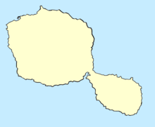
Faa'a International Airport (French: Aéroport international de Tahiti-Faaa), also known as Tahiti International Airport (IATA: PPT, ICAO: NTAA), is the international airport of French Polynesia, located in the commune of Faaa, on the island of Tahiti. It is situated 5 km (3.1 mi) southwest of Papeete, the capital city of the overseas collectivity.[1] It opened in 1960. Regional air carrier Air Tahiti and international air carrier Air Tahiti Nui are both based at the airport.[3]
- ^ a b NTAA – Tahiti Faa'a. AIP from French Service d'information aéronautique, effective 13 June 2024.
- ^ "Statistiques Annuelles – AÉROPORT DE TAHITI – FAA'A". www.aeroport.fr. Union des Aéroports Français. Retrieved March 22, 2020.
- ^ "Préambule Archived 2012-07-16 at archive.today" Air Tahiti. Retrieved on 2 February 2011. "Société Air Tahiti Société Anonyme au capital de 2 760 000 000 CFP Siège social : aéroport de Tahiti – Faaa BP 314 – 98713 Papeete – Tahiti – Polynésie Française ."

