Back 14.º distrito congresional de Florida Spanish حوزه انتخابیه چهاردهم فلوریدا Persian Quatorzième district congressionnel de Floride French
| Florida's 14th congressional district | |
|---|---|
Interactive map of district boundaries since January 3, 2023 | |
| Representative | |
| Area | 366[1] sq mi (950 km2) |
| Distribution |
|
| Population (2023) | 784,928[3] |
| Median household income | $72,238[4] |
| Ethnicity |
|
| Cook PVI | D+8[5] |
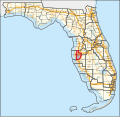
Florida's 14th congressional district is an electoral district for the U.S. Congress and includes western Hillsborough County and southeastern Pinellas County, including most of Tampa. In the 2020 redistricting cycle, the district was redrawn to include almost all areas in both counties which face Tampa Bay, while northeastern Tampa and its neighbouring suburbs are redistricted into the 15th district. The 14th district also includes MacDill Air Force Base and Tampa International Airport.
The former 14th district, in 2003–2012, was located in the Gulf Coast region in Southwestern Florida and included all of Lee County and portions of Charlotte and Collier counties. Fort Myers, Naples, Cape Coral and part of Port Charlotte were located in the district.
From 2013 to 2017, the district was assigned to western Hillsborough County, Florida and Manatee County. After the district boundaries changed in 2017, it was located entirely inside of Hillsborough County[6][7] and included all of Tampa.
The district is currently represented by Democrat Kathy Castor.
- ^ "Congressional Plan--SC14-1905 (Ordered by The Florida Supreme Court, 2-December-2015)" (PDF). Florida Senate Committee on Reapportionment. Retrieved January 11, 2017.
- ^ "Congressional Districts Relationship Files (State-based)". U.S. Census Bureau. Archived from the original on April 2, 2013.
- ^ "My Congressional District".
- ^ "My Congressional District".
- ^ "2022 Cook PVI: District Map and List". Cook Political Report. Retrieved January 10, 2023.
- ^ See whole Florida state map for 2013, with the 14th district covering Sumter County, Hernando to Marion County: h9047_35x42L.pdf Congressional Plan: H000C9047. Chapter No. 2012-2, Laws of Florida. www.flsenate.gov. February 16, 2012.
- ^ See 2013 borders of 14th district in the 2013 districts map: H000C9047_map_bb.pdf, for the Big Bend region of Florida. Congressional Plan: H000C9047. Chapter No. 2012-2, Laws of Florida. www.flsenate.gov. February 2012.

