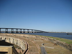
Fort Pike Bridge | |
|---|---|
 Bridge seen from Fort Pike, 2010 | |
| Coordinates | 30°10′21.8″N 89°43′56.9″W / 30.172722°N 89.732472°W |
| Carries | 2 lanes of |
| Crosses | Rigolets |
| Locale | New Orleans and Slidell (Louisiana) |
| Other name(s) | Rigolets Bridge |
| Characteristics | |
| Design | Through truss swing bridge (old), box girder bridge (new) |
| Total length | 3,877.9 feet (1,182 m) |
| Width | 20 feet (6 m) (old), 40 feet (12 m) |
| Longest span | 399.8 feet (122 m) |
| Clearance below | 14.9 feet (5 m)(old), 72 feet (22 m) (new) |
| History | |
| Opened | June 9, 1930 (old) January 15, 2008 (new) |
| Location | |
 | |
The Fort Pike Bridge (also known as the Rigolets Bridge), named after nearby Fort Pike, carries U.S. Route 90 across the Rigolets on the eastern side of Lake Pontchartrain between New Orleans and Slidell in Louisiana. It is owned and operated by Louisiana Department of Transportation and Development[1] The bridge opened on June 9, 1930, and along with the Chef Menteur Bridge provided a free route between New Orleans and the Mississippi Gulf Coast. This was the site of Jayne Mansfield's death in June 1967.[2] A new span was constructed just to the north of the old span.

- ^ "Fort Pike/Rigolets Bridge". bridgehunter.com. Retrieved 2015-07-09.
- ^ "The Night Jayne Mansfield Died, June 29, 1967". Bob Walker's New Orleans Radio Site. Archived from the original on February 17, 2007. Retrieved December 13, 2006.
