This article's factual accuracy may be compromised due to out-of-date information. The reason given is: As of 2023, the metropolitan statistical area only includes three counties. (September 2024) |
Fort Smith metropolitan area | |
|---|---|
| Fort Smith, AR-OK Metropolitan Statistical Area | |
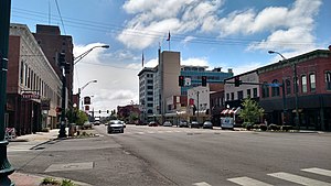
 Downtown Fort Smith | |
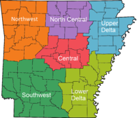
 Map of Fort Smith, AR-OK MSA | |
| Country | |
| State | |
| Principal cities | Fort Smith Van Buren |
| Area | |
| • MSA | 10,000 km2 (4,000 sq mi) |
| Population (2022) | |
| • MSA | 250,368 |
| GDP | |
| • MSA | $12.024 billion (2022) |
| Time zone | UTC-6 (CST) |
| • Summer (DST) | UTC-5 (CDT) |
| Part of a series on |
| Regions of Arkansas |
|---|
 |
The Fort Smith Metropolitan Statistical Area, as defined by the United States Census Bureau, is a five-county area including three Arkansas counties and two Oklahoma counties, and anchored by the city of Fort Smith, Arkansas. The total MSA population in 2000 was 273,170 people, estimated by the Bureau to have grown to 289,693 people by 2007.[2]
Other major cities located within the area include the Arkansas cities of Van Buren and Ozark and the Oklahoma cities of Poteau and Sallisaw. It is directly positioned under Crawford County in the western part of Arkansas.
- ^ "Total Gross Domestic Product for Fort Smith, AR-OK (MSA)". fred.stlouisfed.org.
- ^ "Annual Estimates of the Population of Metropolitan and Micropolitan Statistical Areas: April 1, 2000 to July 1, 2007 (CBSA-EST2007-01)". 2007 Population Estimates. United States Census Bureau, Population Division. 2008-03-27. Archived from the original (CSV) on 2008-09-05. Retrieved 2008-03-28.
