Back مقاطعة فرانكلين (جورجيا) Arabic Franklin County, Georgia BAR Франклин (окръг, Джорджия) Bulgarian ফ্রাঙ্কলিন কাউন্টি, জর্জিয়া BPY Franklin Gông (Georgia) CDO Франклин (гуо, Джорджи) CE Franklin County (kondado sa Tinipong Bansa, Georgia) CEB Franklin County, Georgia Welsh Franklin County (Georgia) German Κομητεία Φράνκλιν (Τζόρτζια) Greek
Franklin County | |
|---|---|
 Franklin County Courthouse in Carnesville | |
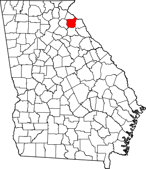
 Location within the U.S. state of Georgia | |
 Georgia's location within the U.S. | |
| Coordinates: 34°22′N 83°14′W / 34.37°N 83.23°W | |
| Country | |
| State | |
| Founded | February 25, 1784 |
| Named for | Benjamin Franklin |
| Seat | Carnesville |
| Largest city | Lavonia |
| Area | |
| • Total | 266 sq mi (690 km2) |
| • Land | 261 sq mi (680 km2) |
| • Water | 5.0 sq mi (13 km2) 1.15% |
| Population (2020) | |
| • Total | 23,424 |
| • Estimate (2023) | 24,782 |
| • Density | 88/sq mi (34/km2) |
| Time zone | UTC−5 (Eastern) |
| • Summer (DST) | UTC−4 (EDT) |
| Congressional district | 9th |
| Website | www |
Franklin County is a county in the Northeast region of the U.S. state of Georgia. As of the 2020 census, the population was 23,424.[1] The county seat is Carnesville.[2] On February 25, 1784, Franklin and Washington became Georgia's eighth and ninth counties,[3] with Franklin named in honor of patriot Benjamin Franklin.[4]
In its original form, Franklin County included all of the territory now in Banks, Barrow, Clarke, Jackson, Oconee, and Stephens counties, and parts of the modern-day Gwinnett, Hall, Hart, and Madison counties, as well as three counties that are now part of South Carolina. Franklin County has several miles of shoreline on Lake Hartwell.
- ^ "Census - Geography Profile: Franklin County, Georgia". United States Census Bureau. Retrieved December 27, 2022.
- ^ "Find a County". National Association of Counties. Archived from the original on May 31, 2011. Retrieved June 7, 2011.
- ^ "Franklin County : County Profile". Georgia State Government. Retrieved September 5, 2011.
- ^ Gannett, Henry (1905). The Origin of Certain Place Names in the United States. Govt. Print. Off. pp. 131.