Back مقاطعة غارفيلد (يوتا) Arabic Garfield County, Utah BAR Гарфілд (акруга, Юта) Byelorussian Гарфийлд (окръг, Юта) Bulgarian গারফিল্ড কাউন্টি, ইউটা BPY Garfield Gông (Utah) CDO Гарфилд (гуо, Юта) CE Garfield County (kondado sa Tinipong Bansa, Utah) CEB Garfield County (Utah) Czech Garfield County, Utah Welsh
Garfield County | |
|---|---|
 Garfield County Courthouse in Panguitch, December 2006 | |
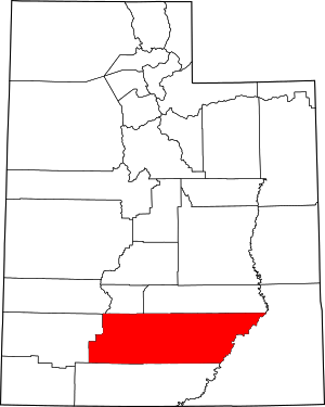
 Location within the U.S. state of Utah | |
 Utah's location within the U.S. | |
| Coordinates: 37°52′N 111°26′W / 37.87°N 111.44°W | |
| Country | |
| State | |
| Founded | March 9, 1882 |
| Named for | James A. Garfield |
| Seat | Panguitch |
| Largest city | Panguitch |
| Area | |
| • Total | 5,208 sq mi (13,490 km2) |
| • Land | 5,175 sq mi (13,400 km2) |
| • Water | 33 sq mi (90 km2) 0.6% |
| Population (2020) | |
| • Total | 5,083 |
| • Density | 0.98/sq mi (0.38/km2) |
| Time zone | UTC−7 (Mountain) |
| • Summer (DST) | UTC−6 (MDT) |
| Congressional district | 2nd |
| Website | garfield |
Garfield County is a county in south central Utah, United States. As of the 2020 United States Census the population was 5,083,[1] making it the fifth-least populous county in Utah; with about one inhabitant per square mile, it is also the least densely populated county in Utah. Its county seat and largest city is Panguitch.[2]
- ^ "Garfield County, Utah". United States Census Bureau. Retrieved June 30, 2023.
- ^ "Find a County". National Association of Counties. Archived from the original on May 31, 2011. Retrieved June 7, 2011.