Back Xeografía de Panamá AST География на Панама Bulgarian Geografio de Panamo Esperanto Geografía de Panamá Spanish جغرافیای پاناما Persian Panaman maantiede Finnish Géographie du Panama French Պանամայի աշխարհագրություն Armenian პანამის გეოგრაფია Georgian Geografia Panamy Polish
 | |
| Continent | North America |
|---|---|
| Region | Caribbean |
| Coordinates | 9°00′N 80°00′W / 9.000°N 80.000°W |
| Area | Ranked 116th |
| • Total | 75,417 km2 (29,119 sq mi) |
| • Land | 98.57% |
| • Water | 1.43% |
| Coastline | 2,490 km (1,550 mi) |
| Borders | Total border: 555 km (345 mi) |
| Highest point | Volcán Barú 3,475 metres (11,401 ft) |
| Lowest point | Pacific Ocean 0 metres (0 ft) |
| Longest river | Chucunaque River 231 km (144 mi) |
| Largest lake | Gatun Lake 425 km2 (164 sq mi) |
| Exclusive economic zone | 335,646 km2 (129,594 sq mi) |

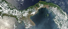
Panama is a country located in Caribbean, bordering both the Caribbean Sea and the Pacific Ocean, between Colombia and Costa Rica. Panama is located on the narrow and low Isthmus of Panama.
This S-shaped isthmus is situated between 7° and 10° north latitude and 77° and 83° west longitude. Panama encompasses approximately 75,417 km2 (29,119 sq mi). It is 772 km (480 mi) long, and between 60 and 177 kilometers (37 and 110 miles) wide.