Back جغرافيا التشيك Arabic Xeografía de Chequia AST Геаграфія Чэхіі Byelorussian География на Чехия Bulgarian চেক প্রজাতন্ত্রের ভূগোল Bengali/Bangla Geografija Češke BS Geografia de Txèquia Catalan Geografie Česka Czech Daearyddiaeth Tsiecia Welsh Tjekkiets geografi Danish
 | |
| Continent | Europe |
|---|---|
| Region | Central Europe |
| Area | Ranked 115th |
| • Total | 78,871 km2 (30,452 sq mi) |
| • Land | 97.88% |
| • Water | 2.12% |
| Coastline | 0 km (0 mi) |
| Borders | 2290.7 km[1] |
| Highest point | Sněžka, 1603.3 m |
| Lowest point | Hřensko, 115 m |
| Longest river | Vltava, 433 km |
| Largest lake | Černé, 18.4 ha |
| Climate | temperate |
| Terrain | hills and lowlands surrounded by low mountains |
| Natural resources | kaolin, lithium, graphite, black coal, brown coal, uranium, timber |
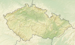
The Czech Republic is a landlocked country in Central Europe. It is bordered by Germany to the west, Austria to the south, Slovakia to the east and Poland to the north. It consists mostly of low hills and plateaus surrounded along the borders by low mountains. Two areas of lowlands follow the Elbe river and the Morava river. About a third of the area of the Czech Republic is covered by forests.
The Czech Republic also possesses Moldauhafen, a 30,000 m2 enclave in the middle of Hamburg docks in Germany, which was awarded to Czechoslovakia by Article 363 of the Treaty of Versailles to allow the landlocked country a place where goods transported down river could be transferred to seagoing ships. This territory reverts to Germany in 2028.
- ^ "Základní informace o ČR" (in Czech). Ministry of Foreign Affairs of the Czech Republic. Retrieved 13 December 2023.