Back Georgetown (lungsod sa Kanada, Ontario) CEB Georgetown (Ontario) Czech Georgetown (Ontario) German جرجتاون، انتاریو Persian Georgetown (Ontario) French Georgetown, Ontario SIMPLE Georgetown, Ontario Swedish جارج ٹاؤن، اونٹاریو Urdu
Georgetown | |
|---|---|
Unincorporated Community | |
 Main Street | |
| Coordinates: 43°39′01″N 79°54′13″W / 43.65028°N 79.90361°W | |
| Country | Canada |
| Province | Ontario |
| Regional municipality | Halton |
| Town | Halton Hills |
| Settled | 1837 |
| Dissolved | 1974 into Halton Hills |
| Government | |
| • Mayor (Halton Hills) | Ann Lawlor |
| Area | |
• Total | 24.03 km2 (9.28 sq mi) |
| Elevation | 258 m (846 ft) |
| Population (2016) | |
• Total | 42,123 |
| • Density | 1,753.1/km2 (4,541/sq mi) |
| Time zone | UTC−05:00 (EST) |
| • Summer (DST) | UTC−04:00 (EDT) |
| Forward sortation area | |
| Area code | 905 / 289 / 365 / 742 |
| Highways | |
| NTS Map | 30M12 Brampton |
| GNBC Code | FBHBE |
| Website | http://www.haltonhills.ca/ |
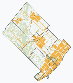
Georgetown is a large unincorporated community in the town of Halton Hills, Ontario, Canada, in the Regional Municipality of Halton. The town includes several small villages or settlements such as Norval, Limehouse, Stewarttown and Glen Williams near Georgetown and another large population centre, Acton.[1] In 2016, the population of Georgetown was 42,123. It sits on the banks of the Credit River, approximately 40 km west of Toronto, and is part of the Greater Toronto Area. Georgetown was named after entrepreneur George Kennedy who settled in the area in 1821 and built several mills and other businesses.
- ^ "Georgetown Neighbourhoods". Archived from the original on 2017-10-28. Retrieved 2017-04-29.

