Back Großraum Vancouver German Granda Vankuvero Esperanto Gran Vancouver Spanish ونکوور بزرگ Persian Grande Vancouver Portuguese Метро Ванкувер Serbian 大溫哥華 Chinese 大溫哥華地區 ZH-YUE
Greater Vancouver | |
|---|---|
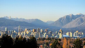
 Vancouver skyline from Queen Elizabeth Park | |
 | |
| Coordinates: 49°14′58″N 122°58′47″W / 49.24944°N 122.97972°W | |
| Country | Canada |
| Province | British Columbia |
| Regional districts | Mainly: Metro Vancouver Extends into: Fraser Valley, Squamish-Lillooet |
| Largest city | Vancouver |
| Government | |
| • Senators | List of senators |
| • MPs | List of MPs |
| • MLAs | List of MLAs |
| Area | |
| • Total | 2,882.68 km2 (1,113.01 sq mi) |
| Elevation | 60 m (200 ft) |
| Population | |
| • Total | 2,642,825 |
| • Density | 916.79/km2 (2,374.5/sq mi) |
| Rank: 3rd | |
| GDP | |
| • Vancouver CMA | CA$164 billion (2020)[5] |
| Time zone | UTC−08:00 (Pacific) |
| • Summer (DST) | UTC−07:00 (PDT) |
| Area code(s) | 604, 778/236/672 |
Municipalities in the Greater Vancouver region | |
Greater Vancouver, also known as Metro Vancouver, is the metropolitan area with its major urban centre being the city of Vancouver, British Columbia, Canada. The term "Greater Vancouver" describes an area that is roughly coterminous with the region governed by the Metro Vancouver Regional District (MVRD), though it predates the 1966 creation of the regional district. It is often used to include areas beyond the boundaries of the regional district but does not generally include wilderness and agricultural areas that are included within the MVRD.
Usage of the term "Greater Vancouver" is not consistent. In local use, it tends to refer to urban and suburban areas only and does not include parts of the regional district such as Bowen Island, although industries such as the film industry even include Squamish, Whistler and Hope as being in "the Vancouver area" or "in Greater Vancouver". The business community often includes adjoining towns and cities such as Mission, Chilliwack, Abbotsford and Squamish within their use of the term "Greater Vancouver", though since the creation of the term "Metro Vancouver", that has come to be used in the media interchangeably with the name of the region and regional district.
As a geographic region, Greater Vancouver is part of the Lower Mainland, one of British Columbia's three main geospatial/cultural divisions, and overlaps with the Lower Fraser Valley, with the Central and Upper Fraser Valley areas to the east being in the Fraser Valley Regional District, which was created from two others upon the expansion of the Greater Vancouver Regional District to include Maple Ridge and Pitt Meadows. Other forms of regional governance and administration whose jurisdiction Greater Vancouver is in are the North Vancouver and Coquitlam Forests Districts, and the Ministry of Environment's Lower Mainland Region (which includes the Sunshine Coast, the Fraser Health Authority and the New Westminster Land District, among others).
- ^ "Population and dwelling counts: Census metropolitan areas, census agglomerations and census subdivisions (municipalities)". Canada 2021 Census. Statistics Canada. 2022. Retrieved May 4, 2024.
- ^ Due to technical issue with OpenStreetMap, some municipalities such as Greater Vancouver A and the Indian reserves could not be identified on this map
- ^ "Census Profile, 2016 Census; Greater Vancouver, Regional District". Statistics Canada. Statistics Canada. Retrieved May 10, 2020.
- ^ "Greater Vancouver, Regional district [Census division], British Columbia and British Columbia [Province]". Statistics Canada. Government of Canada. Retrieved August 18, 2017.
- ^ "Statistics Canada. Table 36-10-0468-01 Gross domestic product (GDP) at basic prices, by census metropolitan area (CMA) (x 1,000,000)". Statistics Canada.
Cite error: There are <ref group=lower-alpha> tags or {{efn}} templates on this page, but the references will not show without a {{reflist|group=lower-alpha}} template or {{notelist}} template (see the help page).
