Back Gundagai (rehiyon) CEB Gundagai Shire German Comté de Gundagai French Contea di Gundagai Italian Gundagai Shire Council Dutch Gundagai Shire Swedish
| Gundagai Shire New South Wales | |||||||||||||||
|---|---|---|---|---|---|---|---|---|---|---|---|---|---|---|---|
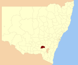
 Location in New South Wales | |||||||||||||||
| Coordinates | 35°04′S 148°07′E / 35.067°S 148.117°E | ||||||||||||||
| Population | 3,747 (2013 est)[1] | ||||||||||||||
| • Density | 1.5250/km2 (3.9498/sq mi) | ||||||||||||||
| Established | 1 January 1924 | ||||||||||||||
| Abolished | 12 May 2016 | ||||||||||||||
| Area | 2,457 km2 (948.7 sq mi) | ||||||||||||||
| Mayor | Cr. Abb McAlister (Unaligned)[2] | ||||||||||||||
| Council seat | Gundagai[3] | ||||||||||||||
| Region | Riverina | ||||||||||||||
| State electorate(s) | Cootamundra | ||||||||||||||
| Federal division(s) | Riverina | ||||||||||||||
| Website | Gundagai Shire | ||||||||||||||
| |||||||||||||||
Gundagai Shire was a local government area in the Riverina region of New South Wales, Australia. On 12 May 2016, Gundagai Shire was abolished and merged with the neighbouring Cootamundra Shire to establish Cootamundra-Gundagai Regional Council.[4]
The Shire was located adjacent to the Hume Highway. Gundagai Shire is primarily rural, with a small population. 80% of the Shire's population live in the town of Gundagai. The four villages in the Shire were Coolac, Tumblong, Muttama and Nangus, with populations ranging from 40 to 90 people.
The last Mayor of Gundagai Shire was Cr. Abb McAlister, an unaligned politician.[2]
- ^ "3218.0 Regional Population Growth, Australia. Table 1. Estimated Resident Population, Local Government Areas, New South Wales". 3 April 2014. Retrieved 11 September 2014.
- ^ a b Cite error: The named reference
mayorwas invoked but never defined (see the help page). - ^ "Gundagai Shire Council". Department of Local Government. Retrieved 9 November 2006.
- ^ "Gundagai Council". New South Wales Government. Archived from the original on 11 June 2016. Retrieved 20 May 2016.