Back مقاطعة هانكوك (ميسيسيبي) Arabic Hancock County, Mississippi BAR Ханкок (окръг, Мисисипи) Bulgarian হানকোক কাউন্টি, মিসিসিপি BPY Hancock Gông (Mississippi) CDO Хэнкок (гуо, Миссисипи) CE Hancock County (kondado sa Tinipong Bansa, Mississippi) CEB Hancock County, Mississippi Welsh Hancock County (Mississippi) Danish Hancock County (Mississippi) German
Hancock County | |
|---|---|
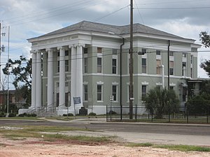
 Hancock County courthouse in Bay St. Louis | |
 Location within the U.S. state of Mississippi | |
 Mississippi's location within the U.S. | |
| Coordinates: 30°23′N 89°28′W / 30.39°N 89.47°W | |
| Country | |
| State | |
| Founded | 1812 |
| Named for | John Hancock |
| Seat | Bay St. Louis |
| Largest city | Bay St. Louis |
| Area | |
| • Total | 553 sq mi (1,430 km2) |
| • Land | 474 sq mi (1,230 km2) |
| • Water | 79 sq mi (200 km2) 14% |
| Population (2020) | |
| • Total | 46,053 |
| • Estimate (2023) | 46,159 |
| • Density | 83/sq mi (32/km2) |
| Time zone | UTC−6 (Central) |
| • Summer (DST) | UTC−5 (CDT) |
| Congressional district | 4th |
| Website | hancockcounty |
Hancock County is the southernmost county of the U.S. state of Mississippi and is named for Founding Father John Hancock.[1] As of the 2020 census, the population was 46,053.[2] Its county seat is Bay St. Louis.[3] Hancock County is part of the Gulfport–Biloxi, MS Metropolitan Statistical Area. It is situated along the Gulf of Mexico and the state line with Louisiana. The area is home to the John C. Stennis Space Center, NASA's largest rocket engine test facility. The county was severely damaged from Hurricane Katrina on August 29, 2005, which caused a huge storm surge and catastrophic damage.
- ^ Gannett, Henry (1905). The Origin of Certain Place Names in the United States. Govt. Print. Off. pp. 148.
- ^ "Census - Geography Profile: Hancock County, Mississippi". United States Census Bureau. Retrieved January 8, 2023.
- ^ "Find a County". National Association of Counties. Retrieved June 7, 2011.